


The editor of the Antarctic Sun says that while Antarctica has always been viewable in Google Maps, the imagery was "about as sharp as the graphics in Pong." The folks at the Polar Geospatial Center came to the rescue.
The Polar Geospatial Center, a project of the University of Minnesota, has updated almost 1,000,000 square kilometers of imagery for both poles, reports Peter Rejcek:
"The informal partnership took shape about a year ago, facilitated by a Google employee on sabbatical who worked a summer season at the South Pole Station's External U.S. government site computer help desk.
[Team leader Paul] Morin and his team of mostly students provide Google with a list of Antarctic regions - from the ice-free McMurdo Dry Valleys External U.S. government site to ice shelves to subantarctic islands - that are scientifically and logistically important."
FULL STORY: Antarctica on Google


Explore US Demographics With the New ACS Atlas Collection
Esri's new ACS Atlas Collection offers interactive applications that visualize the latest U.S. demographic and socio-economic data, enabling users to explore over 175 curated web maps across various thematic areas.

Fighting Forest Pests With AI: A Hemlock Success Story
Fairfax County utilized GeoAI and ArcGIS technology to efficiently map and protect its hemlock trees from the invasive woolly adelgid, ensuring targeted pest management and preservation of its evergreen canopy.
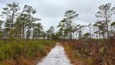
Harnessing GIS and Fire for Longleaf Pine Conservation
Scientists in Florida are using GIS technology to strategically manage prescribed burns, aiding in the restoration and biodiversity of longleaf pine ecosystems while enhancing climate resilience across the Southeast.

Alabama: Trump Terminates Settlements for Black Communities Harmed By Raw Sewage
Trump deemed the landmark civil rights agreement “illegal DEI and environmental justice policy.”

Study: Maui’s Plan to Convert Vacation Rentals to Long-Term Housing Could Cause Nearly $1 Billion Economic Loss
The plan would reduce visitor accommodation by 25% resulting in 1,900 jobs lost.

Planetizen Federal Action Tracker
A weekly monitor of how Trump’s orders and actions are impacting planners and planning in America.

Wind Energy on the Rise Despite Federal Policy Reversal
The Trump administration is revoking federal support for renewable energy, but demand for new projects continues unabated.

Passengers Flock to Caltrain After Electrification
The new electric trains are running faster and more reliably, leading to strong ridership growth on the Bay Area rail system.

Texas Churches Rally Behind ‘Yes in God’s Back Yard’ Legislation
Religious leaders want the state to reduce zoning regulations to streamline leasing church-owned land to housing developers.
Urban Design for Planners 1: Software Tools
This six-course series explores essential urban design concepts using open source software and equips planners with the tools they need to participate fully in the urban design process.
Planning for Universal Design
Learn the tools for implementing Universal Design in planning regulations.
Caltrans
Smith Gee Studio
Institute for Housing and Urban Development Studies (IHS)
City of Grandview
Harvard GSD Executive Education
Toledo-Lucas County Plan Commissions
Salt Lake City
NYU Wagner Graduate School of Public Service