


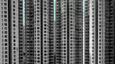
Writing in The New York Times, Geoff Manaugh looks at Christoph Gielen's aerial photography of urban development and sprawl.
Flying overhead in helicopters, Gielen's work explores the anonymity of sprawl developments, and the shapes they create.
"For Gielen's suburban missions, on the other hand, his method is to start with a satellite search, surveying the landscape county-by-county till the right, optically provocative geometries are found. To zoom in further on these arranged environments, he occasionally visits them by car, dressing up as a potential home buyer and touring the sites with a real estate agent, gaining insight into the neighborhood's aspirations: how it sees itself, or, at least, how it is portrayed in the marketing pamphlets and sales pitches of local residents. Far from humanizing the subject, this adds a further layer of abstraction; the landscape's aesthetics, or lack thereof, become economic calculations. Gielen's interest in keeping these locations anonymous only furthers this alienation."
FULL STORY: The Geometry of Sprawl

Friday Eye Candy: Built Environments Expanded Beyond Wildest Dreams
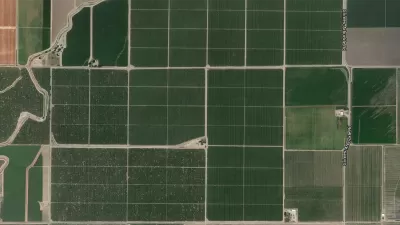
The work of Marcus Lyons replicates images of already sprawling human development to the breaking point and maybe beyond.
Friday Eye Candy: Where U.S. Roads Correct the Grid
Anyone who has traveled long country roads is familiar with the moment when a road makes a sharp turn to deviate from a direct path. Such "grid corrections" provide the subject for a photography project by Gerco de Ruijter.
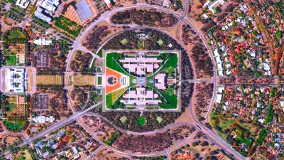
Looking for Inspiration? Try a Daily Dose of a Satellite's Perspective
Here's a strange idea that just might work: viewing the planet from afar might offer the perspective necessary to care for and protect our place in the universe.

Alabama: Trump Terminates Settlements for Black Communities Harmed By Raw Sewage
Trump deemed the landmark civil rights agreement “illegal DEI and environmental justice policy.”

Planetizen Federal Action Tracker
A weekly monitor of how Trump’s orders and actions are impacting planners and planning in America.

Why Should We Subsidize Public Transportation?
Many public transit agencies face financial stress due to rising costs, declining fare revenue, and declining subsidies. Transit advocates must provide a strong business case for increasing public transit funding.

Understanding Road Diets
An explainer from Momentum highlights the advantages of reducing vehicle lanes in favor of more bike, transit, and pedestrian infrastructure.

New California Law Regulates Warehouse Pollution
A new law tightens building and emissions regulations for large distribution warehouses to mitigate air pollution and traffic in surrounding communities.

Phoenix Announces Opening Date for Light Rail Extension
The South Central extension will connect South Phoenix to downtown and other major hubs starting on June 7.
Urban Design for Planners 1: Software Tools
This six-course series explores essential urban design concepts using open source software and equips planners with the tools they need to participate fully in the urban design process.
Planning for Universal Design
Learn the tools for implementing Universal Design in planning regulations.
Caltrans
Smith Gee Studio
Institute for Housing and Urban Development Studies (IHS)
City of Grandview
Harvard GSD Executive Education
Toledo-Lucas County Plan Commissions
Salt Lake City
NYU Wagner Graduate School of Public Service