


Building housing near transportation networks can improve density and walkability, but can also have serious health consequences for residents.
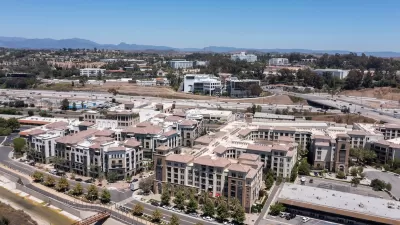
In a piece for Next City, Michael Austin warns that many types of transit-oriented development — which places housing and services near transportation corridors — can have detrimental public health effects when not planned with public health outcomes in mind.
Austin points out that living in close proximity to freeways and major arterial streets is a well-documented health hazard. “Comprehensive articles and academic studies highlight the harmful impacts of living near major roadways, yet development in these areas continues despite known risks.” Even the imminent electrification of the transportation sector, were it to accelerate, wouldn’t completely eliminate emissions, and wouldn’t solve attendant problems such as noise and other sensory impacts.
According to Austin, “When developing TODs along active corridors, it’s important to prioritize housing that’s set no closer than 500 feet — and ideally, 1,000 feet — from major arterials and freeways, as suggested by UCLA researchers and the California Air Resources Board.” He also suggests concentrating commercial, retail, office, and civic uses closer to transit stations.
Austin offers several recommendations for building TOD that takes into account public health: expanding the TOD boundary to include areas farther from major roads; reinforcing health planning through design guidelines; and avoiding housing in active industrial areas.
FULL STORY: Transit-Oriented Housing Development Is Great For Density and Walkability. What About Air Quality?

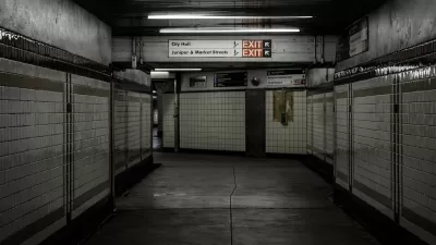
How Does Air Quality in a Philly Subway Station Compare to the Outdoors?
A team of researchers found much higher levels of particulate matter inside the City Hall subway station than on the street-level sidewalks directly above the station.
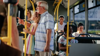
Opinion: To Improve Health Outcomes, Invest in Public Transit
A medical student calls for improving public transit to boost the health of people and the environment.
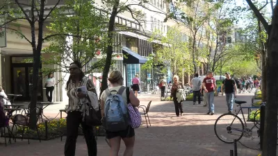
The Relationship Between Walkability and Public Health
New research indicates that improving public health requires targeted investments in more than just pedestrian facilities.

Alabama: Trump Terminates Settlements for Black Communities Harmed By Raw Sewage
Trump deemed the landmark civil rights agreement “illegal DEI and environmental justice policy.”

Study: Maui’s Plan to Convert Vacation Rentals to Long-Term Housing Could Cause Nearly $1 Billion Economic Loss
The plan would reduce visitor accommodation by 25% resulting in 1,900 jobs lost.

Planetizen Federal Action Tracker
A weekly monitor of how Trump’s orders and actions are impacting planners and planning in America.

Waymo Gets Permission to Map SF’s Market Street
If allowed to operate on the traffic-restricted street, Waymo’s autonomous taxis would have a leg up over ride-hailing competitors — and counter the city’s efforts to grow bike and pedestrian on the thoroughfare.

Parklet Symposium Highlights the Success of Shared Spaces
Parklets got a boost during the Covid-19 pandemic, when the concept was translated to outdoor dining programs that offered restaurants a lifeline during the shutdown.

Federal Homelessness Agency Places Entire Staff on Leave
The U.S. Interagency Council on Homelessness is the only federal agency dedicated to preventing and ending homelessness.
Urban Design for Planners 1: Software Tools
This six-course series explores essential urban design concepts using open source software and equips planners with the tools they need to participate fully in the urban design process.
Planning for Universal Design
Learn the tools for implementing Universal Design in planning regulations.
Caltrans
Smith Gee Studio
Institute for Housing and Urban Development Studies (IHS)
City of Grandview
Harvard GSD Executive Education
Toledo-Lucas County Plan Commissions
Salt Lake City
NYU Wagner Graduate School of Public Service