


A new project uses historical records to reconstruct what Columbus neighborhoods looked like before freeways displaced them.
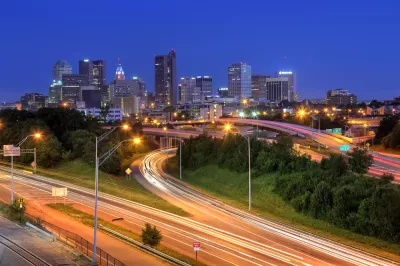
An Ohio State University project known as “Ghost Neighborhoods of Columbus” reconstructs the vibrant communities that once existed in the city before freeways tore through them through 3D imaging, prompting deeper questions such as “How much wealth-generating activities were lost? How many homes? How many institutions?” Mark Ferenchik, writing in the Columbus Dispatch, describes the project. “When you can visualize it, it really takes your breath away,” says project lead and professor Harvey Miller.
The researchers used old fire insurance maps from between 1897 and 1961 as well as historical photographs to reconstruct long-gone neighborhoods with accuracy. They are also interviewing residents who lived in these areas about their experiences. “Based on the OSU research, in Driving Park alone, the losses to the freeway system amounted to 286 houses, 86 garages, five “flats” (apartments), and three businesses.”
Today, some cities, states, and the federal government are beginning to recognize and attempting to redress the damage caused by rampant freeway construction by demolishing or repurposing urban roadways. The federal Reconnecting Communities Act, for example, provides $1 billion for highway removal projects around the country (though it should be noted that the program was whittled down from the originally proposed $20 billion).
FULL STORY: Columbus neighborhoods cut up by freeways being reimagined by Ohio State researchers in 3D

Santa Monica Offers Affordable Housing to Residents Displaced by Freeway Construction
A new program seeks to make restitution for the damage inflicted on Black communities by highway construction and urban renewal.
Bridging Divides: The Crucial Role of Collaboration in Highway Removal
Highway removal is most successful when agencies at all levels of government work closely with each other and the impacted community.
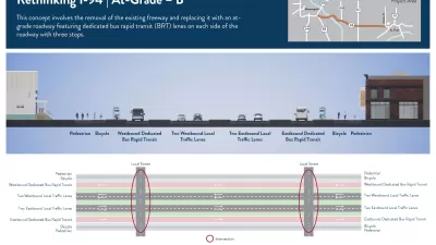
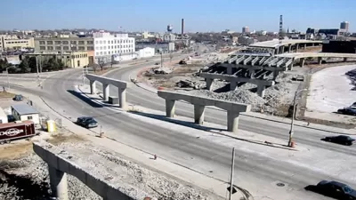
More Options Presented for Minneapolis I-94 Project
Two new proposals for replacing the freeway with at-grade segments offer new visions for the future of downtown Minneapolis.

Alabama: Trump Terminates Settlements for Black Communities Harmed By Raw Sewage
Trump deemed the landmark civil rights agreement “illegal DEI and environmental justice policy.”

Study: Maui’s Plan to Convert Vacation Rentals to Long-Term Housing Could Cause Nearly $1 Billion Economic Loss
The plan would reduce visitor accommodation by 25% resulting in 1,900 jobs lost.

Planetizen Federal Action Tracker
A weekly monitor of how Trump’s orders and actions are impacting planners and planning in America.

Wind Energy on the Rise Despite Federal Policy Reversal
The Trump administration is revoking federal support for renewable energy, but demand for new projects continues unabated.

Passengers Flock to Caltrain After Electrification
The new electric trains are running faster and more reliably, leading to strong ridership growth on the Bay Area rail system.

Texas Churches Rally Behind ‘Yes in God’s Back Yard’ Legislation
Religious leaders want the state to reduce zoning regulations to streamline leasing church-owned land to housing developers.
Urban Design for Planners 1: Software Tools
This six-course series explores essential urban design concepts using open source software and equips planners with the tools they need to participate fully in the urban design process.
Planning for Universal Design
Learn the tools for implementing Universal Design in planning regulations.
Caltrans
Smith Gee Studio
Institute for Housing and Urban Development Studies (IHS)
City of Grandview
Harvard GSD Executive Education
Toledo-Lucas County Plan Commissions
Salt Lake City
NYU Wagner Graduate School of Public Service