


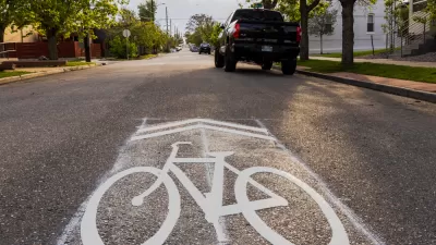
Originally designed as a low-cost way to encourage safer road sharing between bikes and cars, the sharrow has become a symbol of the lack of commitment to protected bike infrastructure in many cities.
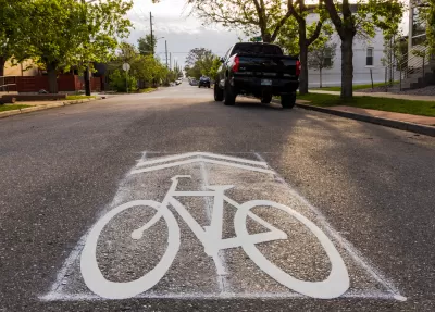
Many cyclists hate them. Most drivers don’t see or understand them. So why are sharrows—the painted symbols also known as lane-share markers—so popular with local governments and departments of transportation?
As Kyle Harris points out in a piece for Denverite, the answer is simple: cost. “Thrifty urban planners, disinterested in building significant bike infrastructure, have embraced them. Sharrows give city officials a cheap way to say they’re doing something for cyclists’ safety — even if it’s undermining it.” Indeed, “According to a 2016 University of Colorado, Denver study of bike infrastructure conducted over ten years and on 2,000 blocks in Chicago, sharrows might actually be more dangerous than no infrastructure at all.”
Harris outlines the history of the sharrow symbol, which was created by now-retired Denver bicycle traffic engineer James Mackay in the early 1990s, when the city resisted any efforts to make changes or invest in bike infrastructure. Mackay developed the symbol as an inexpensive way to encourage drivers and cyclists to share the road, but acknowledges that “Given funding and political will, Mackay knows Denver could have done more, such as cities like Copenhagen and Utrecht, to actively discourage driving and encourage biking.”
FULL STORY: Nobody really understands or likes this street symbol, so how’d it get made?

Calls to Stop Relying on Sharrows Grow Louder
The painted symbols can not only fail to protect bike riders, but can actually make riding conditions less safe.
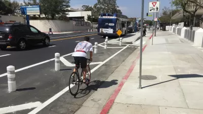
Less Paint, More Barriers, Make for Better Urban Cycling
New research from the University of Colorado Denver and the University of New Mexico sheds light on how to make cities safer for cyclists and other road users and refutes some assumptions about bike safety, such as "safety-in-numbers."
Houston Mayor Promises Dedicated Austin Street Bike Lane After Public Backlash
Although the one-way bike lane won’t be protected by physical barriers, the proposal is an improvement over the mayor’s initial plan to only include sharrows on the Austin Street project.

Alabama: Trump Terminates Settlements for Black Communities Harmed By Raw Sewage
Trump deemed the landmark civil rights agreement “illegal DEI and environmental justice policy.”

Study: Maui’s Plan to Convert Vacation Rentals to Long-Term Housing Could Cause Nearly $1 Billion Economic Loss
The plan would reduce visitor accommodation by 25% resulting in 1,900 jobs lost.

Planetizen Federal Action Tracker
A weekly monitor of how Trump’s orders and actions are impacting planners and planning in America.

Waymo Gets Permission to Map SF’s Market Street
If allowed to operate on the traffic-restricted street, Waymo’s autonomous taxis would have a leg up over ride-hailing competitors — and counter the city’s efforts to grow bike and pedestrian on the thoroughfare.

Parklet Symposium Highlights the Success of Shared Spaces
Parklets got a boost during the Covid-19 pandemic, when the concept was translated to outdoor dining programs that offered restaurants a lifeline during the shutdown.

Federal Homelessness Agency Places Entire Staff on Leave
The U.S. Interagency Council on Homelessness is the only federal agency dedicated to preventing and ending homelessness.
Urban Design for Planners 1: Software Tools
This six-course series explores essential urban design concepts using open source software and equips planners with the tools they need to participate fully in the urban design process.
Planning for Universal Design
Learn the tools for implementing Universal Design in planning regulations.
Caltrans
Smith Gee Studio
Institute for Housing and Urban Development Studies (IHS)
City of Grandview
Harvard GSD Executive Education
Toledo-Lucas County Plan Commissions
Salt Lake City
NYU Wagner Graduate School of Public Service