


The nation's growth slowed from 2010 and 2020, according to 2020 Census data, and demographers are still trying to figure out what population trends mean for the future of country's major metropolitan areas.
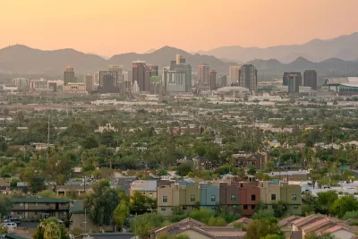
William H. Frey provides insights into the growth, diversity, segregation, and aging trends in the nation’s largest metropolitan areas, as reported by the 2020 Census.
As noted by Frey, the nation’s largest metropolitan areas—with 1 million residents and more—are home to six in ten Americans, and that total is only increasing as major metro areas grew faster than smaller metro areas from 2010 to 2020.
“Moreover, the increased racial and ethnic diversity that characterized the nation is especially concentrated in major metro areas and, in particular, among their youth populations,” writes Frey.
A few other key findings from the article (which synthesizes information presented in a longer report published by Brookings Mountain West), with more detail provided in the source article below:
- Major metro areas grew more slowly since 2010 than in several previous decades.
- The fastest growing metro areas are in the Sun Belt
- Cities grew faster and suburbs slower when compared to the previous decade of the 2000s.
- All major metro areas became more racially and ethnically diverse
- Neighborhood segregation varied by metro area
- The youth population declined and became more diverse
“This analysis of the 2020 census makes plain that the 2010-2020 period represents a transitional decade for the nation’s major metro areas,” according to Frey. That transition “does not lead to a straightforward forecast about [metro areas’] future prospects.”
FULL STORY: Growth, diversity, segregation, and aging in America’s largest metropolitan areas: A 2020 census portrait

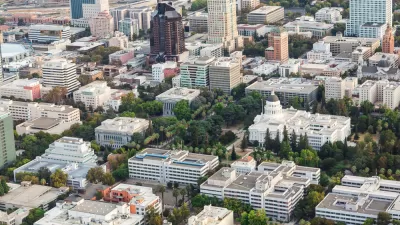
California Halts Three Years of Population Loss
The Golden State grew by 67,000 people, or 0.17%, last year, to just over 39.1 million on Jan. 1, 2024, according to a demographic report released April 30 by the California Department of Finance.

Different Approaches to Fast Growth in Idaho's Treasure Valley
Three cities on the periphery of the fast-growing Treasure Valley showcase different approaches to a sudden influx of newcomers.

Census: Big Cities Lost Population During the Pandemic
For the first time in at least three decades, major metropolitan areas in the U.S. showed negative population growth during the peak of the COVID-19 pandemic.

Alabama: Trump Terminates Settlements for Black Communities Harmed By Raw Sewage
Trump deemed the landmark civil rights agreement “illegal DEI and environmental justice policy.”

Study: Maui’s Plan to Convert Vacation Rentals to Long-Term Housing Could Cause Nearly $1 Billion Economic Loss
The plan would reduce visitor accommodation by 25% resulting in 1,900 jobs lost.

Planetizen Federal Action Tracker
A weekly monitor of how Trump’s orders and actions are impacting planners and planning in America.

Waymo Gets Permission to Map SF’s Market Street
If allowed to operate on the traffic-restricted street, Waymo’s autonomous taxis would have a leg up over ride-hailing competitors — and counter the city’s efforts to grow bike and pedestrian on the thoroughfare.

Parklet Symposium Highlights the Success of Shared Spaces
Parklets got a boost during the Covid-19 pandemic, when the concept was translated to outdoor dining programs that offered restaurants a lifeline during the shutdown.

Federal Homelessness Agency Places Entire Staff on Leave
The U.S. Interagency Council on Homelessness is the only federal agency dedicated to preventing and ending homelessness.
Urban Design for Planners 1: Software Tools
This six-course series explores essential urban design concepts using open source software and equips planners with the tools they need to participate fully in the urban design process.
Planning for Universal Design
Learn the tools for implementing Universal Design in planning regulations.
Caltrans
Smith Gee Studio
Institute for Housing and Urban Development Studies (IHS)
City of Grandview
Harvard GSD Executive Education
Toledo-Lucas County Plan Commissions
Salt Lake City
NYU Wagner Graduate School of Public Service