


The calculator can help transportation advocates and agencies project how many additional miles and emissions a highway widening project would create.
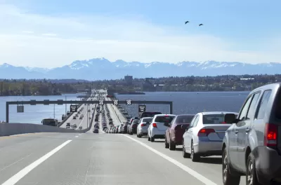
A new tool from nonprofit RMI and a consortium of partners including Transportation for America and the National Resources Defense Council "draws on formulas sourced from decades of proven scientific literature to deliver detailed, community-specific induced demand forecasts with the click of a button." The State Highway Induced Frequency of Travel (SHIFT) Calculator "gives advocates the tools they need to instantly show the real impacts of proposed highway expansions in their communities," writes Kea Wilson, providing a valuable resource for showing the real-world impact of the well-documented but poorly understood phenomenon of induced demand.
"Sustainable transportation advocates and forward-thinking professionals alike have known since at least 1932 that expanding highways to cure congestion almost always has the opposite effect," writes Wilson, but "many of them haven’t been able to quickly quantify exactly how much additional driving a specific project would encourage, or exactly how much all those new vehicle miles traveled will exacerbate the climate crisis — until now."
The tool comes at a crucial time, with billions of dollars for road funding promised in the federal infrastructure bill. The calculator's creators hope it will help state DOTs develop more accurate projections that show the true costs and impacts of road widening.
FULL STORY: New ‘Induced Demand’ Calculator Shows Exactly How Much Driving Your City’s Highway Expansion Will Encourage

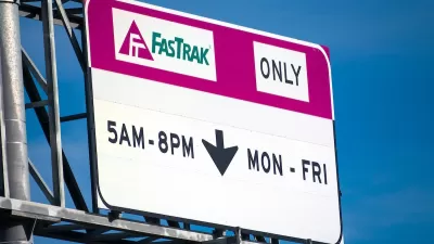
Report: Traffic Slower Near Bay Area Express Lanes
Highway 101 was expanded to add express lanes with the promise of reducing congestion for all of the roadway’s users.
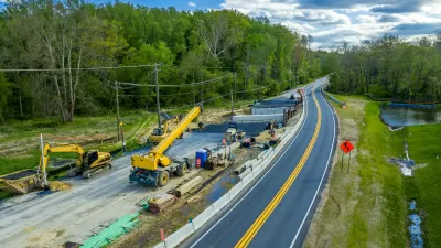
Study: Cost of Expanding Roads Outweighs Benefits
New research shows that the economic benefits of roadbuilding projects don’t come close to exceeding most projects’ costs.

Critics Say New York Highway Expansion Plans Oppose Climate Goals
Plans to widen some roads are drawing backlash from transit advocates who say they will lead to an increase in congestion and truck traffic.

Alabama: Trump Terminates Settlements for Black Communities Harmed By Raw Sewage
Trump deemed the landmark civil rights agreement “illegal DEI and environmental justice policy.”

Planetizen Federal Action Tracker
A weekly monitor of how Trump’s orders and actions are impacting planners and planning in America.

How Atlanta Built 7,000 Housing Units in 3 Years
The city’s comprehensive, neighborhood-focused housing strategy focuses on identifying properties and land that can be repurposed for housing and encouraging development in underserved neighborhoods.

In Both Crashes and Crime, Public Transportation is Far Safer than Driving
Contrary to popular assumptions, public transportation has far lower crash and crime rates than automobile travel. For safer communities, improve and encourage transit travel.

Report: Zoning Reforms Should Complement Nashville’s Ambitious Transit Plan
Without reform, restrictive zoning codes will limit the impact of the city’s planned transit expansion and could exclude some of the residents who depend on transit the most.

Judge Orders Release of Frozen IRA, IIJA Funding
The decision is a victory for environmental groups who charged that freezing funds for critical infrastructure and disaster response programs caused “real and irreparable harm” to communities.
Urban Design for Planners 1: Software Tools
This six-course series explores essential urban design concepts using open source software and equips planners with the tools they need to participate fully in the urban design process.
Planning for Universal Design
Learn the tools for implementing Universal Design in planning regulations.
Jessamine County Fiscal Court
Caltrans
Institute for Housing and Urban Development Studies (IHS)
City of Grandview
Harvard GSD Executive Education
Toledo-Lucas County Plan Commissions
Salt Lake City
NYU Wagner Graduate School of Public Service