


Huge amounts of land are dedicated to asphalt in Kansas City—about twice as much land than is dedicated to buildings. Fiscal dependence on vehicular infrastructure, however, is not unique to Kansas City.
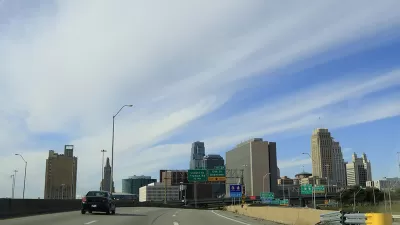
Daniel Herriges' recent Strong Towns article is a part of a longer-term series about the history of Kansas City, Missouri, and the relationship between its development and economy. Up for discussion: "total embrace of the automotive, commuter culture wrought upon the city's historic fabric. And that is parking," writes Herriges.
An animated map of the land uses of Kansas City shows the extent to which parking has taken over large swaths of public space. As planners know well, parking mandates the silent and seemingly invisible force shaping cities and determining lot size and building type.
Prominent in the map are large red arrows pointing to parking structures. Herriges explains the reason for the gargantuan amount of surface parking in downtown Kansas City, describing the lack of demand for downtown real estate as the suburbs became popular in the late 20th century:
If you wanted to speculate on some downtown Kansas City land by buying it when it was cheap and waiting—even for decades—to sell to a developer, slapping a parking lot on that land was an easy way to make a bit of income in the interim. This pattern exists across North America: many of these lots are privately owned and, while they may bring in more than enough revenue to pay the low property taxes on unimproved asphalt, the point isn't really the parking operation. The point is land speculation.
There is more land dedicated to concrete and parking than buildings in Kansas City—over twice as much. Herriges says we need to look at data to identify inefficiencies and understand the fiscal impact of haphazard development.
FULL STORY: Asphalt City: How Parking Ate an American Metropolis

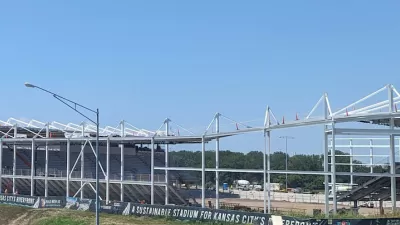
New Kansas City Stadium Offers Limited Parking
Unlike many sports arenas surrounded by seas of concrete, the new CPKC Stadium has parking for just 2,000 vehicles, hoping most sports fans will arrive by transit.
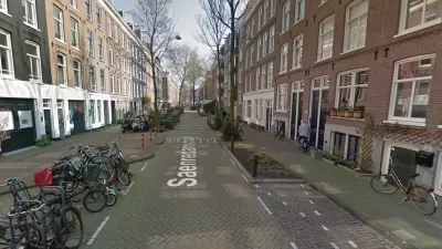
Watch: How to Remove Thousands of Parking Spaces
What the city of Amsterdam will gain by removing cars from on-street parking space.
Will ‘Worst Parking Crater’ Award Produce Policy Change?
Streetsblog doesn’t pull any punches with its “Golden Crater” award—an award for the worst parking crater in the country, selected by a March Madness style tournament. This year's winner/loser: Rochester, New York.

Alabama: Trump Terminates Settlements for Black Communities Harmed By Raw Sewage
Trump deemed the landmark civil rights agreement “illegal DEI and environmental justice policy.”

Study: Maui’s Plan to Convert Vacation Rentals to Long-Term Housing Could Cause Nearly $1 Billion Economic Loss
The plan would reduce visitor accommodation by 25% resulting in 1,900 jobs lost.

Planetizen Federal Action Tracker
A weekly monitor of how Trump’s orders and actions are impacting planners and planning in America.

Waymo Gets Permission to Map SF’s Market Street
If allowed to operate on the traffic-restricted street, Waymo’s autonomous taxis would have a leg up over ride-hailing competitors — and counter the city’s efforts to grow bike and pedestrian on the thoroughfare.

Parklet Symposium Highlights the Success of Shared Spaces
Parklets got a boost during the Covid-19 pandemic, when the concept was translated to outdoor dining programs that offered restaurants a lifeline during the shutdown.

Federal Homelessness Agency Places Entire Staff on Leave
The U.S. Interagency Council on Homelessness is the only federal agency dedicated to preventing and ending homelessness.
Urban Design for Planners 1: Software Tools
This six-course series explores essential urban design concepts using open source software and equips planners with the tools they need to participate fully in the urban design process.
Planning for Universal Design
Learn the tools for implementing Universal Design in planning regulations.
Caltrans
Smith Gee Studio
Institute for Housing and Urban Development Studies (IHS)
City of Grandview
Harvard GSD Executive Education
Toledo-Lucas County Plan Commissions
Salt Lake City
NYU Wagner Graduate School of Public Service