


San Francisco International Airport lies on 5,171-acres of land on eight miles of shoreline along the west side of the San Francisco Bay. Protecting the property from sea-level rise is becoming a more challenging, and expensive, task.
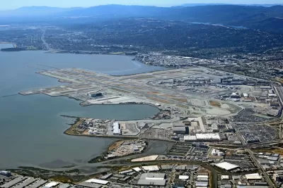
"New sea-level rise projections have increased tenfold the cost to protect the San Francisco International Airport from flooding," reports Joshua Sabatini.
Since 2015, the San Francisco Board of Supervisors has increased the budget for SFO's shoreline protection program from $58 million to $587.1 million. Interest to pay off the bonds that will fund the project will bring the total cost of the project to $1.5 billion.
"City officials attributed the increase to new sea-level rise estimates and guidelines issued by the State of California in a March 2018 report called 'Sea-Level Rise Guidance,'" according to Sabatini. As the budget has risen, so has the expected encroachment of water onto the shoreline surrounding the airport—from 11 inches to 36 inches.
The extra money will fund projects like the construction of a new shoreline protection system around the perimeter of the airport. The system will include "7.6 miles of new sheet pile walls at most of the reaches; new concrete walls at the San Bruno Channel and Millbrae Channel; and 2.7 miles of concrete wall on the Airport front side along Highway 101," according to the "Sea-Level Rise Guidance" report.
FULL STORY: Costs soar for shoreline protections as SFO plans for rising seas

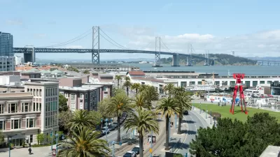
San Francisco's Mission Bay Provides a Case Study for Sea-Level Rise
The San Francisco Chronicle's John King continues his ongoing, in-depth coverage of sea-level rise and its potential impacts on local and regional concerns in the San Francisco Bay Area.
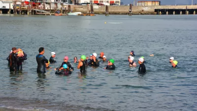
Proposed Pool Would Make an Olympic-Sized Play Area in the San Francisco Bay
The San Francisco Bay is usually an undesirable place to swim, except for a hearty few. A development proposal seeking assistance at the state level would add a pool to the Bay’s waters to make the idea of going for a swim more appealing.
Austin Scores Highest on Pandemic Recovery; Bay Area and Baltimore Lowest
The Bay Area Council and CBRE created an economic tracker to measure how well the nation's 25 largest metropolitan areas have recovered from the public health restrictions imposed on their regions at the onset of the pandemic.

Alabama: Trump Terminates Settlements for Black Communities Harmed By Raw Sewage
Trump deemed the landmark civil rights agreement “illegal DEI and environmental justice policy.”

Study: Maui’s Plan to Convert Vacation Rentals to Long-Term Housing Could Cause Nearly $1 Billion Economic Loss
The plan would reduce visitor accommodation by 25% resulting in 1,900 jobs lost.

Planetizen Federal Action Tracker
A weekly monitor of how Trump’s orders and actions are impacting planners and planning in America.

Waymo Gets Permission to Map SF’s Market Street
If allowed to operate on the traffic-restricted street, Waymo’s autonomous taxis would have a leg up over ride-hailing competitors — and counter the city’s efforts to grow bike and pedestrian on the thoroughfare.

Parklet Symposium Highlights the Success of Shared Spaces
Parklets got a boost during the Covid-19 pandemic, when the concept was translated to outdoor dining programs that offered restaurants a lifeline during the shutdown.

Federal Homelessness Agency Places Entire Staff on Leave
The U.S. Interagency Council on Homelessness is the only federal agency dedicated to preventing and ending homelessness.
Urban Design for Planners 1: Software Tools
This six-course series explores essential urban design concepts using open source software and equips planners with the tools they need to participate fully in the urban design process.
Planning for Universal Design
Learn the tools for implementing Universal Design in planning regulations.
Caltrans
Smith Gee Studio
Institute for Housing and Urban Development Studies (IHS)
City of Grandview
Harvard GSD Executive Education
Toledo-Lucas County Plan Commissions
Salt Lake City
NYU Wagner Graduate School of Public Service