


A long term plan to add an additional bridge connection across the Chesapeake Bay is underway in Maryland.
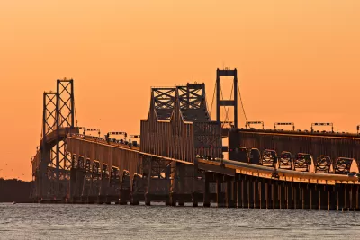
"It’s been discussed for several years, and now the state of Maryland and the Federal Highway Administration are conducting a $5 million study to look at where a new Chesapeake Bay Bridge crossing might work best," reports John Domen.
A series of maps [pdf] are already public, showing 14 potential crossings of the Chesapeake Bay, from Aberdeen to the north and Lexington Park to the south.
"This early in the process, there is a wide range of possibilities on the table, with different reasons for their impracticality," according to Domen. "But those that seem more feasible may find other roadblocks instead."
Domen describes a bit about each of the 14 potential crossings, and also highlights some of the potential political backlash a new bridge could face from either side of the political aisle.

FULL STORY: Potential new Bay Bridge crossings revealed

Maryland Spending $5 Million to Study Another Span for the Bay Bridge
Maryland Governor Larry Hogan has thrown support behind a study to add a third span to the Bay Bridge that spans the Chesapeake Bay.
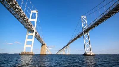
Potential Routes for New Bridge Across the Chesapeake Winnowed From 14 to 3
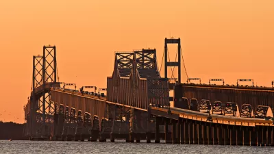
The Maryland Transportation Authority has been studying the potential of a new bridge across the Chesapeake Bay, connecting Annapolis to Queen Anne's County to the East.
Editorial: The Best New Chesapeake Bay Bridge Is No New Chesapeake Bay Bridge
The Baltimore Sun Editorial Board finds numerous faults with the state of Maryland's preliminary investigation of an idea to add another bridge across the Chesapeake Bay near Annapolis.

Alabama: Trump Terminates Settlements for Black Communities Harmed By Raw Sewage
Trump deemed the landmark civil rights agreement “illegal DEI and environmental justice policy.”

Planetizen Federal Action Tracker
A weekly monitor of how Trump’s orders and actions are impacting planners and planning in America.

Why Should We Subsidize Public Transportation?
Many public transit agencies face financial stress due to rising costs, declining fare revenue, and declining subsidies. Transit advocates must provide a strong business case for increasing public transit funding.

Understanding Road Diets
An explainer from Momentum highlights the advantages of reducing vehicle lanes in favor of more bike, transit, and pedestrian infrastructure.

New California Law Regulates Warehouse Pollution
A new law tightens building and emissions regulations for large distribution warehouses to mitigate air pollution and traffic in surrounding communities.

Phoenix Announces Opening Date for Light Rail Extension
The South Central extension will connect South Phoenix to downtown and other major hubs starting on June 7.
Urban Design for Planners 1: Software Tools
This six-course series explores essential urban design concepts using open source software and equips planners with the tools they need to participate fully in the urban design process.
Planning for Universal Design
Learn the tools for implementing Universal Design in planning regulations.
Caltrans
Smith Gee Studio
Institute for Housing and Urban Development Studies (IHS)
City of Grandview
Harvard GSD Executive Education
Toledo-Lucas County Plan Commissions
Salt Lake City
NYU Wagner Graduate School of Public Service