


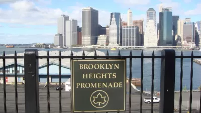
The Brooklyn Heights Promenade will be closed as the Brooklyn-Queens Expressway below it is replaced. A Brownstoner column celebrates the esplanade's 68th birthday on Oct. 7, noting its troubled past and connection to Robert Moses.
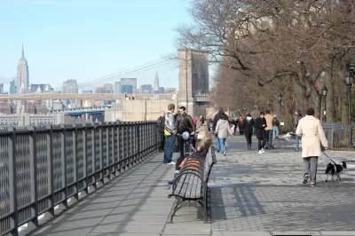
On Oct. 7, 1950, the Brooklyn Heights Promenade, known for its views of Lower Manhattan and New York Harbor, opened to the public. Sitting on top of a 0.4-mile-long, triple-cantilevered section of the Brooklyn-Queens Expressway, the popular walkway could be closed for up to six years as the Expressway is replaced.

Image and text by NYCDOT: Project Overview of the BQE – Atlantic to Sands Project. [If the image isn't visible, see NYCDOT image (jpg)].
Susan De Vries, research editor for Brownstoner, penned a column discussing the current plans of the New York City Department of Transportation, and the roadway's troubled history at the hands of Robert Moses, with links to related articles on Brooklyn neighborhood history.
See Brownstoner's YouTube video showing human and motorized traffic on all three elevated levels of the Triple Cantilever.
Construction of the overlook and the cantilevered Brooklyn-Queens Expressway underneath started in 1946 after a contentious battle between Robert Moses and the community, which was intent on keeping a transportation project from cutting apart their neighborhood.
"More than anyone else in recent history, Robert Moses shaped the physical infrastructure of Brooklyn," wrote Suzanne Spellen in February 2016. "We drive on his roads, stroll through his parks, live in his housing developments and are surrounded by his influence at every turn."
Most people are aware that Robert Moses built the BQE, and chose to cut a trench through the working-class neighborhoods of what was then known as South Brooklyn, separating Red Hook from the rest of the borough and what later became Carroll Gardens.
He would have continued that trench straight through Hicks Street in Brooklyn Heights, destroying that neighborhood as well. But the people in the Heights had more political power than those in Red Hook, and the great compromise that created the Promenade saved the area [...]
"Brooklyn Heights Is Fighting Robert Moses Again," writes Ginia Bellafante in her Big City weekly column published Sunday in The New York Times.
In terms of its built environment, New York now contains two cities in conflict. One is the gleaming 21st-century metropolis of the Bloomberg administration's imagination; the other is the deteriorating landscape onto which it was almost mindlessly grafted, one scarred in so many places by the benighted ambitions of Robert Moses.
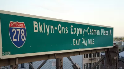
On Oct. 4, Times metro reporter Winnie Hue detailed the two plans under consideration to replace the deteriorating 1.5-mile stretch of the BQE and what it would mean for the replacement of the Promenade (spoiler alert: it could be a widened walkway).
Related in Planetizen:
-
Much Hand Wringing After Brooklyn-Queens Expressway Replacement Plans Announced, September 24, 2018New York City Transportation Commissioner Polly Trottenberg characterized the project to replace a section of the Brooklyn-Queens Expressway in Brooklyn heights as New York's "Big Dig."
-
A $1.7 Billion Highway Project Looms in Brooklyn, November 8, 2016The Brooklyn-Queens Expressway (BQE) is built atop a crumbling series of bridges. The city is expected to go into high gear constructing Brooklyn's only interstate highway by the beginning of the next decade.
FULL STORY: The Brooklyn Heights Promenade Opened to the Public 68 Years Ago This Month

Shrinking Highways: Could the Brooklyn-Queens Expressway Be the First?
Highways have been razed, replaced with boulevards, and streets have been placed on road diets, but what about lane reductions on interstate highways? That's one recommendation in a report released Thursday by a panel of experts on the BQE.
Much Hand Wringing After Brooklyn-Queens Expressway Replacement Plans Announced
New York City Transportation Commissioner Polly Trottenberg compared the project to replace a section of the Brooklyn-Queens Expressway in Brooklyn heights as New York's "Big Dig."
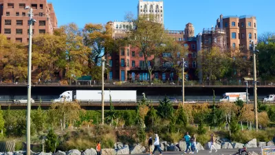
Expressway Expansion Could Threaten Brooklyn Bridge Park
Supporters of the waterfront park worry NYCDOT’s plan to potentially widen the Brooklyn-Queens Expressway could reduce green space in “one of the most expensive urban parks ever built.”

Alabama: Trump Terminates Settlements for Black Communities Harmed By Raw Sewage
Trump deemed the landmark civil rights agreement “illegal DEI and environmental justice policy.”

Planetizen Federal Action Tracker
A weekly monitor of how Trump’s orders and actions are impacting planners and planning in America.

Why Should We Subsidize Public Transportation?
Many public transit agencies face financial stress due to rising costs, declining fare revenue, and declining subsidies. Transit advocates must provide a strong business case for increasing public transit funding.

Understanding Road Diets
An explainer from Momentum highlights the advantages of reducing vehicle lanes in favor of more bike, transit, and pedestrian infrastructure.

New California Law Regulates Warehouse Pollution
A new law tightens building and emissions regulations for large distribution warehouses to mitigate air pollution and traffic in surrounding communities.

Phoenix Announces Opening Date for Light Rail Extension
The South Central extension will connect South Phoenix to downtown and other major hubs starting on June 7.
Urban Design for Planners 1: Software Tools
This six-course series explores essential urban design concepts using open source software and equips planners with the tools they need to participate fully in the urban design process.
Planning for Universal Design
Learn the tools for implementing Universal Design in planning regulations.
Caltrans
Smith Gee Studio
Institute for Housing and Urban Development Studies (IHS)
City of Grandview
Harvard GSD Executive Education
Toledo-Lucas County Plan Commissions
Salt Lake City
NYU Wagner Graduate School of Public Service