


A new map shows where privately owned public spaces are located to encourage more public use.

In 1961, New York City started its program for privately owned public spaces (POPS), which gave private developers bonus floor area or waivers in exchange for providing and maintaining publicly accessible spaces on their properties. Over 550 of these POPS exist in the city today, with most located in Manhattan. However, the number of POPS in other boroughs throughout the city is increasing.
Although POPS are available for the public to use, the city has found that they are not as accessible as they should be. “While the city is home to hundreds of POPS, most people are unaware of their existence or location, and in many cases buildings were found to be in violation of the POPS laws, and restrict access to the public,” reports Tanay Warerkar.
To better inform the public, the New York City Department of City Planning has put together an interactive map of the city’s POPS. In addition to each site’s location, the map details amenities, hours of access, and information about the building. Today’s POPS are mainly public plazas and arcades, and the city hopes that more awareness of these urban spaces will lead to an increase in their use.
FULL STORY: Handy new map shows all of NYC’s privately-owned public spaces

Contest: Design a Logo for New York's Privately-Owned Public Spaces
New York City is holding a competition for a distinctive logo to clearly demarcate all of its 550 privately-owned public spaces.
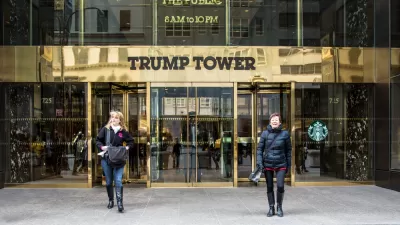
Report: Trump Tower Among Many NYC Buildings Not Maintaining Privately Owned Public Spaces
It's no secret that building owners often fail to maintain privately owned public spaces with any priority on the public part of that equation. A new report reveals just how widespread the problem is in New York.
The Not-So-Public Legacy of New York's Privately Owned Public Spaces
More and more often, barriers have been erected between the public and POPS, as privately owned public spaces are known.

Alabama: Trump Terminates Settlements for Black Communities Harmed By Raw Sewage
Trump deemed the landmark civil rights agreement “illegal DEI and environmental justice policy.”

Study: Maui’s Plan to Convert Vacation Rentals to Long-Term Housing Could Cause Nearly $1 Billion Economic Loss
The plan would reduce visitor accommodation by 25% resulting in 1,900 jobs lost.

Planetizen Federal Action Tracker
A weekly monitor of how Trump’s orders and actions are impacting planners and planning in America.

Waymo Gets Permission to Map SF’s Market Street
If allowed to operate on the traffic-restricted street, Waymo’s autonomous taxis would have a leg up over ride-hailing competitors — and counter the city’s efforts to grow bike and pedestrian on the thoroughfare.

Parklet Symposium Highlights the Success of Shared Spaces
Parklets got a boost during the Covid-19 pandemic, when the concept was translated to outdoor dining programs that offered restaurants a lifeline during the shutdown.

Federal Homelessness Agency Places Entire Staff on Leave
The U.S. Interagency Council on Homelessness is the only federal agency dedicated to preventing and ending homelessness.
Urban Design for Planners 1: Software Tools
This six-course series explores essential urban design concepts using open source software and equips planners with the tools they need to participate fully in the urban design process.
Planning for Universal Design
Learn the tools for implementing Universal Design in planning regulations.
Caltrans
Smith Gee Studio
Institute for Housing and Urban Development Studies (IHS)
City of Grandview
Harvard GSD Executive Education
Toledo-Lucas County Plan Commissions
Salt Lake City
NYU Wagner Graduate School of Public Service