


As visitors seek out ways to reach the lake’s increasingly distant shoreline, officials say illegally created roads are damaging environmental and cultural resources and leading to hundreds of calls for rescue for stranded vehicles.
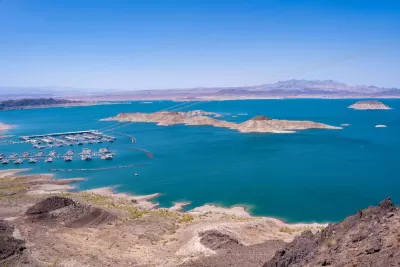
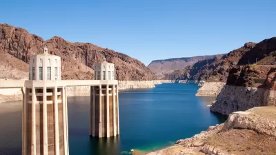
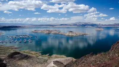
As water levels in Lake Mead and other western reservoirs reach perilous lows, people desperate to access the lake’s shores are creating a growing network of illegal roads that threaten the environment in Lake Mead National Recreation Area. “The park service has documented 824 miles of illegal roads, although the agency estimates two to three times that many exist.”
As Amy Alonzo explains in an article for the Nevada Independent, “When water levels were higher, an official road reached the lakeshore roughly every 10 miles, providing approximately 60 access points for visitors.” Now, only 10 approved roads exist, with half of them concentrated at one beach, making access to most of the lake’s shores “virtually nonexistent.”
Now, “Visitors have thus taken it upon themselves to create new roadways, including driving between official roads in attempts to reach isolated points along the water.” Park officials say vehicles on these roads destroy environmental and cultural resources and often require assistance after getting stuck — with few ways to describe to rescuers where they are.
The National Park Service (NPS) is requesting $8.67 million in federal funding to address the illegal roads by creating specific management plans, defining where backcountry camping is allowed, and boosting enforcement. “Park officials are also considering implementing a permitting system for camping — either free or paid — and putting location boundaries on backcountry use.”
FULL STORY: Lake Mead’s illegal road network is growing

Western States Face New Round of Water Cuts
In Nevada, efforts to conserve water include a ban on ornamental grass and regulations on swimming pool sizes.
Colorado River States Inch Closer to Agreement
Upper Basin and Lower Basin states each say their plan for conserving the Colorado River’s water is the most sustainable.
The Year in Public Lands
Public policy decisions that will impact land and water conservation in the American West.

Study: Maui’s Plan to Convert Vacation Rentals to Long-Term Housing Could Cause Nearly $1 Billion Economic Loss
The plan would reduce visitor accommodation by 25,% resulting in 1,900 jobs lost.

North Texas Transit Leaders Tout Benefits of TOD for Growing Region
At a summit focused on transit-oriented development, policymakers discussed how North Texas’ expanded light rail system can serve as a tool for economic growth.

Why Should We Subsidize Public Transportation?
Many public transit agencies face financial stress due to rising costs, declining fare revenue, and declining subsidies. Transit advocates must provide a strong business case for increasing public transit funding.

How Community Science Connects People, Parks, and Biodiversity
Community science engages people of all backgrounds in documenting local biodiversity, strengthening connections to nature, and contributing to global efforts like the City Nature Challenge to build a more inclusive and resilient future.

Alabama: Trump Terminates Settlements for Black Communities Harmed By Raw Sewage
Trump deemed the landmark civil rights agreement “illegal DEI and environmental justice policy.”

Dear Tesla Driver: “It’s not You, It’s Him.”
Amidst a booming bumper sticker industry, one writer offers solace to those asking, “Does this car make me look fascist?”
Urban Design for Planners 1: Software Tools
This six-course series explores essential urban design concepts using open source software and equips planners with the tools they need to participate fully in the urban design process.
Planning for Universal Design
Learn the tools for implementing Universal Design in planning regulations.
City of Santa Clarita
Ascent Environmental
Institute for Housing and Urban Development Studies (IHS)
City of Grandview
Harvard GSD Executive Education
Toledo-Lucas County Plan Commissions
Salt Lake City
NYU Wagner Graduate School of Public Service