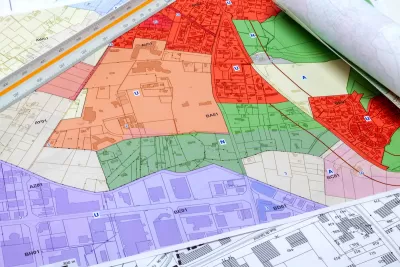
A massive effort is underway to compile local zoning regulations and other laws that impact how and where housing is built.

Historically left to local jurisdictions, zoning laws are now being assessed at the state and even national level as the housing crisis reaches all corners of the country. Could a ‘national zoning atlas’ spur change?
Kriston Capps describes the project in an article for Bloomberg CityLab, writing that “when complete, [the project] will offer users a neighborhood-level view of the zoning codes set by some 30,000 different local governments.” Teams in at least 25 states are working to compile this data, inspired by a Connecticut project. “[B]y pairing zoning maps with census data and other sources, researchers can shine a light on specific problems or places — and in at least a couple states so far, mapping out zoning codes has led to real change.”
The atlas could become an important tool because “Most local governments don’t fully understand their own zoning rules, which can be byzantine documents with fragmented, antiquated or contradictory rules accreted over decades.”
FULL STORY: Can a National Zoning Atlas Chart a Way Out of the US Housing Crisis?

Study: Maui’s Plan to Convert Vacation Rentals to Long-Term Housing Could Cause Nearly $1 Billion Economic Loss
The plan would reduce visitor accommodation by 25,% resulting in 1,900 jobs lost.

North Texas Transit Leaders Tout Benefits of TOD for Growing Region
At a summit focused on transit-oriented development, policymakers discussed how North Texas’ expanded light rail system can serve as a tool for economic growth.

Using Old Oil and Gas Wells for Green Energy Storage
Penn State researchers have found that repurposing abandoned oil and gas wells for geothermal-assisted compressed-air energy storage can boost efficiency, reduce environmental risks, and support clean energy and job transitions.

Santa Barbara Could Build Housing on County Land
County supervisors moved forward a proposal to build workforce housing on two county-owned parcels.

San Mateo Formally Opposes Freeway Project
The city council will send a letter to Caltrans urging the agency to reconsider a plan to expand the 101 through the city of San Mateo.

A Bronx Community Fights to Have its Voice Heard
After organizing and giving input for decades, the community around the Kingsbridge Armory might actually see it redeveloped — and they want to continue to have a say in how it goes.
Urban Design for Planners 1: Software Tools
This six-course series explores essential urban design concepts using open source software and equips planners with the tools they need to participate fully in the urban design process.
Planning for Universal Design
Learn the tools for implementing Universal Design in planning regulations.
Ascent Environmental
Borough of Carlisle
Institute for Housing and Urban Development Studies (IHS)
City of Grandview
Harvard GSD Executive Education
Toledo-Lucas County Plan Commissions
Salt Lake City
NYU Wagner Graduate School of Public Service


