


The new data can help communities identify risks and assess potential land use impacts in coastal areas.
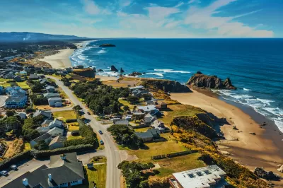
The National Oceanic and Atmospheric Administration (NOAA) announced a new land cover dataset that can help coastal communities assess their risk from sea level rise and plan for mitigation measures.
The land cover data improves on past available data with higher resolution that is 900 times more detailed than before. “Land cover data is frequently used in coastal management applications, and is the backbone of key predictive models for sea level rise and stormwater management,” explains a press release from NOAA. Local jurisdictions can use the data to assess flood risk, understand land use impacts, model future infrastructure projects, and more.
The project was funded with $8 million from the Bipartisan Infrastructure Law and private sector partnerships. According to the release, “This announcement is particularly important for Alaska, as the state has never had widespread high-resolution land cover data.”
FULL STORY: Biden-Harris Administration shares new land cover data to help communities understand coastal change


Rising Above: Innovative Solutions for Waikīkī’s Sea-Level Challenges
The University of Hawaiʻi at Mānoa’s award-winning Waikīkī sea-level rise adaptation project combines science, architecture, and community input to create scalable solutions for climate resilience and coastal flood mitigation.

California State Law Calls on Coastal Regions to Create Resiliency Plans
Cities and counties at risk of flooding and erosion from sea level rise can access state funding to implement coastal resiliency plans.
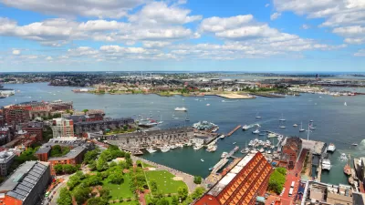
Study To Assess Climate Mitigation Options for East Boston
A grant-funded research team will evaluate solutions for shoring up the area’s flood protection strategies and improving access and service on the Blue Line for local residents.

Study: Maui’s Plan to Convert Vacation Rentals to Long-Term Housing Could Cause Nearly $1 Billion Economic Loss
The plan would reduce visitor accommodation by 25,% resulting in 1,900 jobs lost.

North Texas Transit Leaders Tout Benefits of TOD for Growing Region
At a summit focused on transit-oriented development, policymakers discussed how North Texas’ expanded light rail system can serve as a tool for economic growth.

Using Old Oil and Gas Wells for Green Energy Storage
Penn State researchers have found that repurposing abandoned oil and gas wells for geothermal-assisted compressed-air energy storage can boost efficiency, reduce environmental risks, and support clean energy and job transitions.

Private Donations Propel Early Restoration of Palisades Playground
Los Angeles has secured over $1.3 million in private funding to restore the Pacific Palisades playground months ahead of schedule, creating a modern, accessible space that supports community healing after recent wildfires.

From Blight to Benefit: Early Results From California’s Equitable Cleanup Program
The Equitable Community Revitalization Grant (ECRG) program is reshaping brownfield redevelopment by prioritizing projects in low-income and environmental justice communities, emphasizing equity, transparency, and community benefits.

Planting Relief: Tackling Las Vegas Heat One Tree at a Time
Nevada Plants, a Las Vegas-based nonprofit, is combating the city’s extreme urban heat by giving away trees to residents in underserved neighborhoods, promoting shade, sustainability, and community health.
Urban Design for Planners 1: Software Tools
This six-course series explores essential urban design concepts using open source software and equips planners with the tools they need to participate fully in the urban design process.
Planning for Universal Design
Learn the tools for implementing Universal Design in planning regulations.
Ascent Environmental
Borough of Carlisle
Institute for Housing and Urban Development Studies (IHS)
City of Grandview
Harvard GSD Executive Education
Toledo-Lucas County Plan Commissions
Salt Lake City
NYU Wagner Graduate School of Public Service