


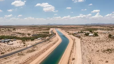
A new analysis of U.S. and Mexico groundwater supplies reveals 72 aquifers shared between the two countries.
A new map of groundwater supplies could change the shape of water management and conservation policy in the U.S. Southwest and Mexico, reports Caroline Tracey in High Country News. “On Dec. 28, researchers released the first complete map of the groundwater basins that span the U.S.-Mexico boundary. It demarcates 72 shared aquifers — a striking contrast to the countries’ official count of 11.”
The map comes from research by Rosario Sánchez and Laura Rodríguez published in Transboundary Aquifers: Challenges and the Way Forward. “It shows five shared aquifers between Baja California and California, 26 between Sonora and Arizona, and 33 between Texas and the Mexican states of Chihuahua, Coahuila, Nuevo León, and Tamaulipas. Of these, 45% are considered to be in ‘good to moderate’ condition.”
The two countries have not previously collaborated on water regulation efforts, leading to incongruous uses and unsustainable exploitation of water resources, Tracey explains. The research standardizes the definition of an aquifer, which the authors hope will contribute to a better shared understanding of the intertwined water resources in the two countries. “Felicia Marcus of the Water Policy Group added that maps like the one Sánchez and Rodríguez produced ‘are helpful for transparency and allow for more engagement of the affected communities,’ particularly in resolution of disputes.”
More on the Southwest's water crisis:
FULL STORY: Researchers solve one of the Borderlands’ biggest water puzzles

Arizona Governor Takes Steps to Modernize Water Policy
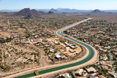
A newly released report warns of rapidly dwindling groundwater resources as developers plan to build hundreds of thousands of new homes.
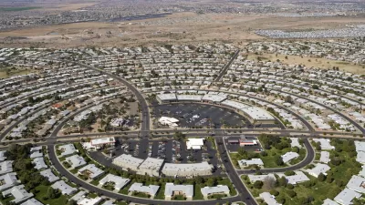
Arizona’s Growth Threatens Water Supplies
New communities are popping up across Arizona’s desert, evading water consumption restrictions and straining the state’s groundwater supplies.
Utah Debates Solutions to Water Shortage
With a rapidly growing population and strained water supplies, Utah lawmakers and conservation groups debate how to best replenish the state's water sources.

Study: Maui’s Plan to Convert Vacation Rentals to Long-Term Housing Could Cause Nearly $1 Billion Economic Loss
The plan would reduce visitor accommodation by 25,% resulting in 1,900 jobs lost.

North Texas Transit Leaders Tout Benefits of TOD for Growing Region
At a summit focused on transit-oriented development, policymakers discussed how North Texas’ expanded light rail system can serve as a tool for economic growth.

Why Should We Subsidize Public Transportation?
Many public transit agencies face financial stress due to rising costs, declining fare revenue, and declining subsidies. Transit advocates must provide a strong business case for increasing public transit funding.

How to Make US Trains Faster
Changes to boarding platforms and a switch to electric trains could improve U.S. passenger rail service without the added cost of high-speed rail.

Columbia’s Revitalized ‘Loop’ Is a Hub for Local Entrepreneurs
A focus on small businesses is helping a commercial corridor in Columbia, Missouri thrive.

Invasive Insect Threatens Minnesota’s Ash Forests
The Emerald Ash Borer is a rapidly spreading invasive pest threatening Minnesota’s ash trees, and homeowners are encouraged to plant diverse replacement species, avoid moving ash firewood, and monitor for signs of infestation.
Urban Design for Planners 1: Software Tools
This six-course series explores essential urban design concepts using open source software and equips planners with the tools they need to participate fully in the urban design process.
Planning for Universal Design
Learn the tools for implementing Universal Design in planning regulations.
City of Santa Clarita
Ascent Environmental
Institute for Housing and Urban Development Studies (IHS)
City of Grandview
Harvard GSD Executive Education
Toledo-Lucas County Plan Commissions
Salt Lake City
NYU Wagner Graduate School of Public Service