


Traffic safety analysis inspires debate about the culprit (drivers or engineers?) on the least safe stretch of road in the Buckeye State.
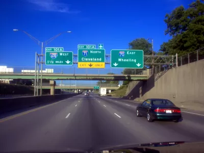
"An analysis of the latest federal fatal traffic crash data found that a portion of Interstate 71 in Columbus ranked as the deadliest 5-mile stretch of roadway in Ohio during a three-year period," reports Eric Lagatta.
Lagatta is sharing findings from analysis by MoneyGeek of National Highway Traffic Safety Administration data. The study analyzed "data on fatal crashes between 2017 and 2019 and found that 10 fatal crashes occurred on I-71 between 11th Avenue to the south and Morse Road to the north — the most for any 5-mile stretch in the state," explains Lagatta.
The Ohio Department of Transportation in August completed the "South Side Mega Fix" widening project on a seven-mile stretch of I-71 between Interstate-70 and Stringtown Road—located to the south of the five-mile stretch identified by the MoneyGeek analysis.
In a follow up article to the coverage by Lagatta, Theodore Decker put the study's findings to the test [paywall] by driving the stretch on a continuous loop in heaby rain, "exiting repeatedly at 11th Avenue on the south and Morse Road on the north, only to merge right back on the freeway and the loop over."
While Decker reports numerous bad driving behaviors, the article also sets up Ohio Department of Transportation officials with a case to widen the freeway, like it did to the south, to relieve bottlenecks and congestion. "On deadly stretch of I-71, the road may be getting a bad rap," reads the headline, and Decker assigns blame for the poor safety record of the freeway to drivers speeding and driving recklessly in poor weather conditions: "I-71 between 11th and Morse has its share of design problems, and ODOT needs to fix them. But the fact of the matter is this: The deaths on that stretch often were the result of individuals making bad choices. And those individuals were not the civil engineers."
FULL STORY: Five-mile stretch of Interstate-71 in Columbus ranks as deadliest in Ohio, analysis finds

Construction Set to Begin on $1.6 Billion Highway Widening in Texas
Construction is expected to begin on the Southeast Connector highway widening project near Fort Worth in the spring and wrap up in 2027.

Let’s End Traffic Stops
The technology to make traffic enforcement obsolete is becoming available. But in the U.S. willing to use it?

Ohio Pledges $51 Million for Traffic Safety
The state’s department of transportation will invest in a variety of traffic safety projects as traffic fatalities reach their highest level in decades.

Study: Maui’s Plan to Convert Vacation Rentals to Long-Term Housing Could Cause Nearly $1 Billion Economic Loss
The plan would reduce visitor accommodation by 25,% resulting in 1,900 jobs lost.

North Texas Transit Leaders Tout Benefits of TOD for Growing Region
At a summit focused on transit-oriented development, policymakers discussed how North Texas’ expanded light rail system can serve as a tool for economic growth.

Why Should We Subsidize Public Transportation?
Many public transit agencies face financial stress due to rising costs, declining fare revenue, and declining subsidies. Transit advocates must provide a strong business case for increasing public transit funding.

How to Make US Trains Faster
Changes to boarding platforms and a switch to electric trains could improve U.S. passenger rail service without the added cost of high-speed rail.

Columbia’s Revitalized ‘Loop’ Is a Hub for Local Entrepreneurs
A focus on small businesses is helping a commercial corridor in Columbia, Missouri thrive.

Invasive Insect Threatens Minnesota’s Ash Forests
The Emerald Ash Borer is a rapidly spreading invasive pest threatening Minnesota’s ash trees, and homeowners are encouraged to plant diverse replacement species, avoid moving ash firewood, and monitor for signs of infestation.
Urban Design for Planners 1: Software Tools
This six-course series explores essential urban design concepts using open source software and equips planners with the tools they need to participate fully in the urban design process.
Planning for Universal Design
Learn the tools for implementing Universal Design in planning regulations.
Ascent Environmental
Borough of Carlisle
Institute for Housing and Urban Development Studies (IHS)
City of Grandview
Harvard GSD Executive Education
Toledo-Lucas County Plan Commissions
Salt Lake City
NYU Wagner Graduate School of Public Service