


The Indiana Department of Transportation is preparing to spend $337.8 million to improve the I-465 and I-69 interchange on the north side of Indianapolis.
Ethan May shares news of a newly released visualization of a planned reconstruction of the I-465 and I-69 interchange on the north side of Indianapolis.
The flyover is available for public viewing, as shared here thanks to the Indiana Department of Transportation's YouTube page. May's coverage of the video includes timestamps of explanations for significant moments in the five-minute-long video. According to that extra layer of explanation, one of the most significant components of the project is captured at the very beginning of the video: "Instead of a one-lane loop ramp, drivers heading to I-69 from eastbound I-465 will have a two-lane ramp that runs under I-465 and enters the left side of I-69."
In a separate article published in October, May provides additional explanation of the project, noting that the Indiana Department of Transportation is planning on spending $337.8 million to rebuild the interchange and add lanes to I-465. The project is scheduled to begin construction in the spring of 2022 and wrap up in 2024, according to May.
Add the I-465/I-69 project to the list of major highway investments underway in the Indianapolis area right now. "It's not the only or even the next major interstate project slated for the city: Work is expected to begin this winter on a total rebuild of the North Split interchange of I-65 and I-70 downtown," adds May in the October article. Planetizen picked up news of local opposition of the I-65/I-70 split in February 2018, and Susan Orr was reporting on that project in September 2017.
FULL STORY: This flyover shows how the rebuilt I-465/I-69 interchange may look

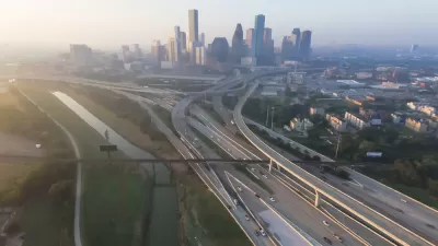
Environmental Study Released for $7 Billion Houston Highway Project
The final environmental impact statement for the controversial North Houston Highway Improvement Project is available for public comment, courtesy of the Texas Department of Transportation.
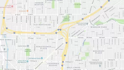
State Plan to Expand a Downtown Indianapolis Intersection Meets Local Resistance
Local urbanists are opposing a plan to greatly expand a freeway intersection in neighborhoods adjacent to Downtown Indianapolis.
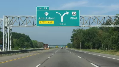
Michigan DOT Nixes Ann Arbor Highway Expansion
In response to public feedback, the Michigan Department of Transportation is no longer considering options to widen U.S. 23 on Ann Arbor’s east side.

Alabama: Trump Terminates Settlements for Black Communities Harmed By Raw Sewage
Trump deemed the landmark civil rights agreement “illegal DEI and environmental justice policy.”

Study: Maui’s Plan to Convert Vacation Rentals to Long-Term Housing Could Cause Nearly $1 Billion Economic Loss
The plan would reduce visitor accommodation by 25% resulting in 1,900 jobs lost.

Why Should We Subsidize Public Transportation?
Many public transit agencies face financial stress due to rising costs, declining fare revenue, and declining subsidies. Transit advocates must provide a strong business case for increasing public transit funding.

Paris Bike Boom Leads to Steep Drop in Air Pollution
The French city’s air quality has improved dramatically in the past 20 years, coinciding with a growth in cycling.

Why Housing Costs More to Build in California Than in Texas
Hard costs like labor and materials combined with ‘soft’ costs such as permitting make building in the San Francisco Bay Area almost three times as costly as in Texas cities.

San Diego County Sees a Rise in Urban Coyotes
San Diego County experiences a rise in urban coyotes, as sightings become prevalent throughout its urban neighbourhoods and surrounding areas.
Urban Design for Planners 1: Software Tools
This six-course series explores essential urban design concepts using open source software and equips planners with the tools they need to participate fully in the urban design process.
Planning for Universal Design
Learn the tools for implementing Universal Design in planning regulations.
Smith Gee Studio
Alamo Area Metropolitan Planning Organization
City of Santa Clarita
Institute for Housing and Urban Development Studies (IHS)
City of Grandview
Harvard GSD Executive Education
Toledo-Lucas County Plan Commissions
Salt Lake City
NYU Wagner Graduate School of Public Service