


We seem to have an app for everything. Now we have one that walks a viewer through the river’s history from the pre-historic era to the present.

The Los Angeles River is 51 miles long and spans through 17 cities and unincorporated Los Angeles County. The river encompasses an 834-square-mile watershed and flows from its headwaters at river mile 51 in Canoga Park within the city of Los Angeles to river mile zero at Long Beach, where the river meets the Pacific Ocean. The L.A. River was channelized between the late 19th and mid-20th centuries to protect lives and property from flooding as the L.A. region rapidly grew and transformed to a largely urbanized area. Today, one million people live within one mile of the river.
To help folks learn more about and better appreciate the L.A. River, there is now the "Rio de Los Angeles" app. This new augmented reality app was produced by RYOT, a production studio run by Verizon Media that specializes in interactive and immersive experiences, in collaboration with digital studios Vrai Pictures and Superbright. According to Jake Sally, head of development at RYOT, “The L.A. River is amazing, but it’s also hundreds of pages and graphs and data sets, and they are not accessible,” he says. “So can we build a depth of understanding? ... How can people who are in the immediate proximity to the river have a greater understanding of how their small piece fits into the larger context?”
The free app offers a fun, interactive experience for iPhone and iPad that walks a viewer through some of the river’s history from the pre-historic era to the present. Just point your iPhone or iPad at a flat surface and a 3-D map of the Los Angeles Basin loads up on the screen. From there, a menu of options walks the viewer through the river’s history, from the shifting waterway on a broad flood plain to the channelized water body encased in concrete. The app was developed using data from various sources, including historic archives and the L.A. River Index, a research database assembled by River LA, one of the groups involved in the planned redevelopment of the river through an update of the L.A. River Master Plan.
River L.A. has been leading the coordination of an extensive community engagement and outreach process for the Master Plan. This effort was launched by L.A. County Public Works to update the original 1996 master plan, synthesizing more recent ideas for portions of the River and bringing a comprehensive vision to the transformation of the L.A. River.
FULL STORY: The Los Angeles River as you’ve never seen it — in augmented reality


Gehry's Plans for Los Angeles River Restoration Gaining Clarity
Details are emerging in the controversial effort by Gehry Partners, LLP to plan a new vision for the Los Angeles River. So far, however, Gehry Partners seems to have been listening more than plotting or drawing.
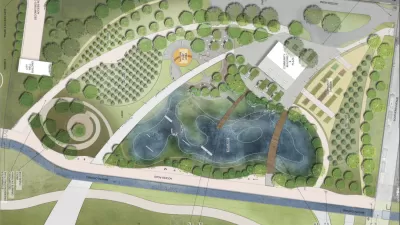
An 'Urban Orchard' Next to the Los Angeles River
The city of South Gate, located on the southern stretch of the Los Angeles River, downriver of Downtown Los Angeles, recently published an initial study of the "Urban Orchard Project."

Los Angeles County: It's Time to Update the Master Plan for the L.A. River
The Los Angeles County Board of Supervisors voted this week to begin the processing of updating the 20-year-old Los Angeles River Master Plan.

Study: Maui’s Plan to Convert Vacation Rentals to Long-Term Housing Could Cause Nearly $1 Billion Economic Loss
The plan would reduce visitor accommodation by 25,% resulting in 1,900 jobs lost.

North Texas Transit Leaders Tout Benefits of TOD for Growing Region
At a summit focused on transit-oriented development, policymakers discussed how North Texas’ expanded light rail system can serve as a tool for economic growth.

Why Should We Subsidize Public Transportation?
Many public transit agencies face financial stress due to rising costs, declining fare revenue, and declining subsidies. Transit advocates must provide a strong business case for increasing public transit funding.

How to Make US Trains Faster
Changes to boarding platforms and a switch to electric trains could improve U.S. passenger rail service without the added cost of high-speed rail.

Columbia’s Revitalized ‘Loop’ Is a Hub for Local Entrepreneurs
A focus on small businesses is helping a commercial corridor in Columbia, Missouri thrive.

Invasive Insect Threatens Minnesota’s Ash Forests
The Emerald Ash Borer is a rapidly spreading invasive pest threatening Minnesota’s ash trees, and homeowners are encouraged to plant diverse replacement species, avoid moving ash firewood, and monitor for signs of infestation.
Urban Design for Planners 1: Software Tools
This six-course series explores essential urban design concepts using open source software and equips planners with the tools they need to participate fully in the urban design process.
Planning for Universal Design
Learn the tools for implementing Universal Design in planning regulations.
City of Santa Clarita
Ascent Environmental
Institute for Housing and Urban Development Studies (IHS)
City of Grandview
Harvard GSD Executive Education
Toledo-Lucas County Plan Commissions
Salt Lake City
NYU Wagner Graduate School of Public Service