


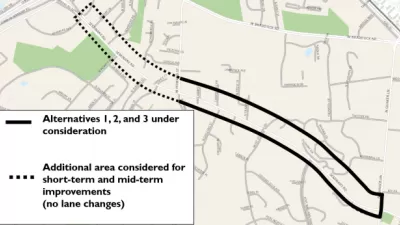
The draft new Montgomery County Complete Streets design guide is a key tool for achieving the goals set out by the county's Vision Zero Action Plan.

Montgomery County, Maryland recently released the draft Montgomery County Complete Streets design guide ahead of a public review process expected to culminate before the County Council in January 2021.
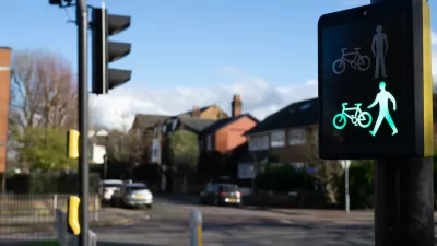
"Complete Streets are roadways that are designed and operated to provide safe, accessible, and healthy travel for all users of the roadway system, including pedestrians, bicyclists, transit riders, and motorists," according to the Montgomery Planning website that shares the draft.
According to the website, the Design Guide is designed to offer flexibility to the various communities in the county while adhering to three principles: safety, sustainability, and vitality. The Complete Streets Design Guide is intended to further the county's Vision Zero goals to reduce traffic fatalities.
Given the current debate about the centering of equity in transportation planning and the need for planners to address the lack of safety for people of color while traveling on every available mode of transportation, I did a quick search and found only two uses of the word equity—both times mentioning that traffic collisions disproportionately affect people of color, but in neither case offering any specifics about how the deployment of complete streets principles for the Vision Zero agenda would address disparities in traffic safety or access to mobility.
The history of planning in Montgomery County is fraught with criticisms of discriminatory practices, but some local officials and advocates have been moving the needle toward equity in recent months.
FULL STORY: Complete Streets Design Guide

When it Comes to Road Diets, Evidence Doesn't Matter
Drivers are a powerful enough lobby to overcome all evidence of the need to redesign streets for safety. Examples from Maryland and Virginia provide the latest case studies in Vision Zero futility.

‘Complete Streets’ Webpage Deleted in Federal Purge
Basic resources and information on building bike lanes and sidewalks, formerly housed on the government’s Complete Streets website, are now gone.
‘Safe Land Use:’ A Key to Road Safety
How approaching transportation planning through a public health lens can reduce traffic deaths.

Alabama: Trump Terminates Settlements for Black Communities Harmed By Raw Sewage
Trump deemed the landmark civil rights agreement “illegal DEI and environmental justice policy.”

Study: Maui’s Plan to Convert Vacation Rentals to Long-Term Housing Could Cause Nearly $1 Billion Economic Loss
The plan would reduce visitor accommodation by 25% resulting in 1,900 jobs lost.

Planetizen Federal Action Tracker
A weekly monitor of how Trump’s orders and actions are impacting planners and planning in America.

Waymo Gets Permission to Map SF’s Market Street
If allowed to operate on the traffic-restricted street, Waymo’s autonomous taxis would have a leg up over ride-hailing competitors — and counter the city’s efforts to grow bike and pedestrian on the thoroughfare.

Parklet Symposium Highlights the Success of Shared Spaces
Parklets got a boost during the Covid-19 pandemic, when the concept was translated to outdoor dining programs that offered restaurants a lifeline during the shutdown.

Federal Homelessness Agency Places Entire Staff on Leave
The U.S. Interagency Council on Homelessness is the only federal agency dedicated to preventing and ending homelessness.
Urban Design for Planners 1: Software Tools
This six-course series explores essential urban design concepts using open source software and equips planners with the tools they need to participate fully in the urban design process.
Planning for Universal Design
Learn the tools for implementing Universal Design in planning regulations.
Caltrans
Smith Gee Studio
Institute for Housing and Urban Development Studies (IHS)
City of Grandview
Harvard GSD Executive Education
Toledo-Lucas County Plan Commissions
Salt Lake City
NYU Wagner Graduate School of Public Service