


Metro is analyzing new geolocational data to look beyond conventional understandings of travel behavior.
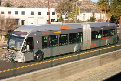
Adam Rogers reports on efforts at the Los Angeles County Metropolitan Transportation Authority to better understand how people travel and the ways bus service could be revamped to meet these needs and entice people to switch modes.
Using locational data from cell phones, Conan Cheung at Metro found the expected morning and afternoon peaks related to schools and work. But the data also showed a third peak, one that is not commute related, says Rogers:
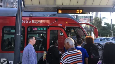
That was new. "What we know from traditional surveys is, people remember their biggest trips," [Anurag] Komanduri says. "But what people forget is 'I'm picking up the laundry,' 'I'm stopping to grab coffee.' We see more of these data captured by cell phones." Those trips, the futzing around of daily life, tend to happen in off-peak hours—from midday into the evening, 8 or 9 o'clock.
A closer look at these short trips compared transit and driving trip times. "Some 85 percent of trips could be taken on mass transit, but fewer than half were as fast as driving," writes Rogers. And when more comparisons were made using fare card data, Cheung discovered that on routes with the same travel time, only 13 percent of that travel happened on transit.
The challenge, says Rogers, is figuring out how to use and balance the incentives for transit use and the disincentives for driving—the carrots and the sticks. Improving transit service, increasing housing density, and implementing congestion pricing are all strategies that can help get people out of their cars.
But he also argues that Los Angeles needs to take bold steps to stop designing the city around driving. "This is the baller move: Stop making cars easy and everything else hard. Tear down some freeways. Make retail districts pedestrian-only. Strew commercial corridors with curbside parklets, protected bike lanes, scooter-share services, and apartment buildings with first-floor retail and no parking. Make it illegal to park on the street—on every street. Put buses and trains everywhere."
FULL STORY: LA’S PLAN TO REBOOT ITS BUS SYSTEM—USING CELL PHONE DATA

The Environmental Costs of Slow, Empty Buses
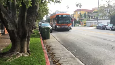
Flagging ridership on Metro buses in Los Angeles redoubles the need to speed buses up with dedicated lanes, hopefully recovering lost riders and finding some news ones along the way, too.
NextGen Bus Plan Approved in Los Angeles
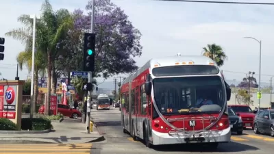
Major changes are coming to the Metro bus system in the nation's second largest city. After three years of planning and public feedback, the Metro board has approved the NextGen bus plan.
Bus Ridership Declines Challenge Los Angeles
The Wall Street Journal reports that bus riders on the Los Angeles County Transportation Authority system has declined significantly in recent years.

Study: Maui’s Plan to Convert Vacation Rentals to Long-Term Housing Could Cause Nearly $1 Billion Economic Loss
The plan would reduce visitor accommodation by 25,% resulting in 1,900 jobs lost.

North Texas Transit Leaders Tout Benefits of TOD for Growing Region
At a summit focused on transit-oriented development, policymakers discussed how North Texas’ expanded light rail system can serve as a tool for economic growth.

Using Old Oil and Gas Wells for Green Energy Storage
Penn State researchers have found that repurposing abandoned oil and gas wells for geothermal-assisted compressed-air energy storage can boost efficiency, reduce environmental risks, and support clean energy and job transitions.

Private Donations Propel Early Restoration of Palisades Playground
Los Angeles has secured over $1.3 million in private funding to restore the Pacific Palisades playground months ahead of schedule, creating a modern, accessible space that supports community healing after recent wildfires.

From Blight to Benefit: Early Results From California’s Equitable Cleanup Program
The Equitable Community Revitalization Grant (ECRG) program is reshaping brownfield redevelopment by prioritizing projects in low-income and environmental justice communities, emphasizing equity, transparency, and community benefits.

Planting Relief: Tackling Las Vegas Heat One Tree at a Time
Nevada Plants, a Las Vegas-based nonprofit, is combating the city’s extreme urban heat by giving away trees to residents in underserved neighborhoods, promoting shade, sustainability, and community health.
Urban Design for Planners 1: Software Tools
This six-course series explores essential urban design concepts using open source software and equips planners with the tools they need to participate fully in the urban design process.
Planning for Universal Design
Learn the tools for implementing Universal Design in planning regulations.
Ascent Environmental
Borough of Carlisle
Institute for Housing and Urban Development Studies (IHS)
City of Grandview
Harvard GSD Executive Education
Toledo-Lucas County Plan Commissions
Salt Lake City
NYU Wagner Graduate School of Public Service