


Cleveland neighborhoods were coded to help real estate investors, but the result is a map that harks back to old discriminatory housing practices, say critics.
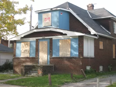
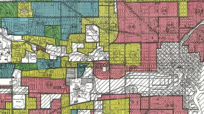
Brentin Mock reports on recent controversy over a 2015 blog post about a map of Cleveland that looks much like redlining maps from the last century. The map, produced by a local real estate developer, graded the city’s neighborhoods, ostensibly to provide investors with a guide to where they might get the best return on investments.
But, says Mock, the grades highlight race and class segregation throughout the city:
The red “F” category is called the “Warzone” in [James] Wise’s blog, and consists of the African-American East Cleveland neighborhood and several zip codes that have majority black populations, and most of which have incomes below $22,000. The D category, also red, consists of just three neighborhoods, each of which have sizable black and Latino populations, all located in the city and with majority renter populations.
The Home Owners Loan Corporation redlining maps of the 1930s divided the city based on similar metrics, and designations of “neighborhood desirability” drove investment and home loan decisions. “Desirability was defined by the neighborhood’s household incomes, the percentage of homeowners, and by 'homogeneity'—whether white people made up the majority of the neighborhood,” reports Mock.
Some housing advocates wonder if the more recent map could actually help residents in lower-income neighborhoods over the long run. Investors looking to flip properties and make a quick buck might be motivated to steer clear of Cleveland’s most vulnerable neighborhoods, says Mock.
FULL STORY: The Brazen Redlining Happening in Cleveland

Putting the Myth of the Redlining Maps to Rest
Home Owners’ Loan Corporation (HOLC) maps have long been blamed for racial inequities in today’s Black neighborhoods, but recent research shows that’s misleading.
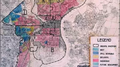
New Research Reexamines HOLC's Role in Redlining
New Deal agencies did engage in discriminatory lending practices–but not quite in the way we think.

Cleveland Has Yet to Recover From the Last Recession
Decades of racist policy and a lack of critical resources have left Cleveland in a perpetual state of economic fragility. The city can't afford another recession.

Study: Maui’s Plan to Convert Vacation Rentals to Long-Term Housing Could Cause Nearly $1 Billion Economic Loss
The plan would reduce visitor accommodation by 25,% resulting in 1,900 jobs lost.

North Texas Transit Leaders Tout Benefits of TOD for Growing Region
At a summit focused on transit-oriented development, policymakers discussed how North Texas’ expanded light rail system can serve as a tool for economic growth.

Why Should We Subsidize Public Transportation?
Many public transit agencies face financial stress due to rising costs, declining fare revenue, and declining subsidies. Transit advocates must provide a strong business case for increasing public transit funding.

How to Make US Trains Faster
Changes to boarding platforms and a switch to electric trains could improve U.S. passenger rail service without the added cost of high-speed rail.

Columbia’s Revitalized ‘Loop’ Is a Hub for Local Entrepreneurs
A focus on small businesses is helping a commercial corridor in Columbia, Missouri thrive.

Invasive Insect Threatens Minnesota’s Ash Forests
The Emerald Ash Borer is a rapidly spreading invasive pest threatening Minnesota’s ash trees, and homeowners are encouraged to plant diverse replacement species, avoid moving ash firewood, and monitor for signs of infestation.
Urban Design for Planners 1: Software Tools
This six-course series explores essential urban design concepts using open source software and equips planners with the tools they need to participate fully in the urban design process.
Planning for Universal Design
Learn the tools for implementing Universal Design in planning regulations.
Ascent Environmental
Borough of Carlisle
Institute for Housing and Urban Development Studies (IHS)
City of Grandview
Harvard GSD Executive Education
Toledo-Lucas County Plan Commissions
Salt Lake City
NYU Wagner Graduate School of Public Service