


What do you think about the linked visual presentation of the history of urban planning?

.jpg)
Nick Routley shares a detailed infographic created by Konstantin von der Schulenburg, an architect with Cantrell and Crowley Architects and Interior Designer.
The infographic was first posted by von der Schulenburg at the Intercultural Urbanism blog in April 2016, sparking debate there about the design and wording choices made in the infographic.
Routley revives the infographic and presents additional history as background for the movements described in the infographic. Click through to see the graphics that support this narrative of the history of urban planning: The Nolli Map>Garden City>The Setback Principle>Broadacre City>Radiant City>Psychogeography>The Megaregion>The Transect.
FULL STORY: The Evolution of Urban Planning

Planning Year in Review 2023: Zoning Reform, a Rail Revolution, and Climate Realities
Last year’s most talked-about planning issues and news.

Planetizen’s Top Posts of 2023
The most-read articles on Planetizen in 2023.
All We Want for the Holidays is…
Here are a dozen timely gift ideas for creating better communities.

Study: Maui’s Plan to Convert Vacation Rentals to Long-Term Housing Could Cause Nearly $1 Billion Economic Loss
The plan would reduce visitor accommodation by 25,% resulting in 1,900 jobs lost.

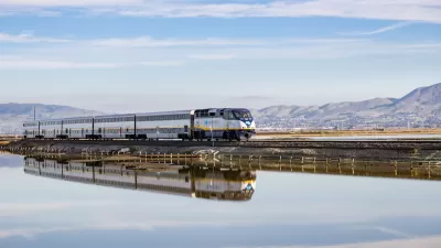
North Texas Transit Leaders Tout Benefits of TOD for Growing Region
At a summit focused on transit-oriented development, policymakers discussed how North Texas’ expanded light rail system can serve as a tool for economic growth.

Using Old Oil and Gas Wells for Green Energy Storage
Penn State researchers have found that repurposing abandoned oil and gas wells for geothermal-assisted compressed-air energy storage can boost efficiency, reduce environmental risks, and support clean energy and job transitions.

Private Donations Propel Early Restoration of Palisades Playground
Los Angeles has secured over $1.3 million in private funding to restore the Pacific Palisades playground months ahead of schedule, creating a modern, accessible space that supports community healing after recent wildfires.

From Blight to Benefit: Early Results From California’s Equitable Cleanup Program
The Equitable Community Revitalization Grant (ECRG) program is reshaping brownfield redevelopment by prioritizing projects in low-income and environmental justice communities, emphasizing equity, transparency, and community benefits.

Planting Relief: Tackling Las Vegas Heat One Tree at a Time
Nevada Plants, a Las Vegas-based nonprofit, is combating the city’s extreme urban heat by giving away trees to residents in underserved neighborhoods, promoting shade, sustainability, and community health.
Urban Design for Planners 1: Software Tools
This six-course series explores essential urban design concepts using open source software and equips planners with the tools they need to participate fully in the urban design process.
Planning for Universal Design
Learn the tools for implementing Universal Design in planning regulations.
Ascent Environmental
Borough of Carlisle
Institute for Housing and Urban Development Studies (IHS)
City of Grandview
Harvard GSD Executive Education
Toledo-Lucas County Plan Commissions
Salt Lake City
NYU Wagner Graduate School of Public Service