


A new book of maps, photographs, and essays considers the rich historic legacy of land use and transportation on and around the Great Lakes.
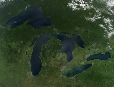
The Great Lakes. Major architecture and landscape architecture ideas were tested here. The car gained prominence here. Ports gained prominence here. Edited by Charles Waldheim, Mason White, Clare Lyster, and Daniel Ibanez, the Third Coast Atlas is a cartographic and photographic essay of where the area around the Great Lakes has come from and where it stands today.
The Third Coast Atlas discusses many topics dealing with the Great Lakes through history, ranging from geology to early trade, and today's struggling rust belt cities. It also looks to the future with ideas like a "Free Water Zone," a mixed-use district where users can take free water from the Great Lakes for industrial uses as long as they return it in pristine condition.
FULL STORY: The Story of the Great Lakes in 8 Maps

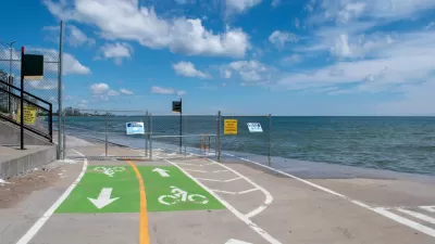
Lessons From the Viral Video of Lake Michigan Taking Out a Bike Commuter
Climate change will only increase the frequency of incidents like the one captured by a television news station in Chicago earlier this week.
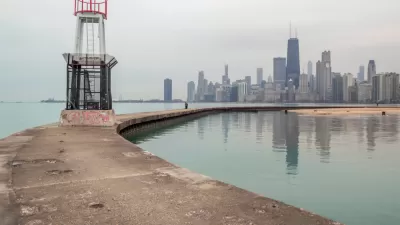
Lake Michigan Wreaking Havoc on Chicago This Summer
Lake Michigan has reached historic levels this summer. Properties on the Far North Side are most at risk. Swimmers have already been called back from the shore.
Gertrude Kerbis, Pioneering Female Architect
Architect Gertrude Kerbis worked for sixty years designing buildings in Chicago alongside more famous architects like Walter Gropius and Mies Van der Rohe. Preservation Magazine talks to her about her struggles as a woman in a male-dominated field.

Study: Maui’s Plan to Convert Vacation Rentals to Long-Term Housing Could Cause Nearly $1 Billion Economic Loss
The plan would reduce visitor accommodation by 25,% resulting in 1,900 jobs lost.

North Texas Transit Leaders Tout Benefits of TOD for Growing Region
At a summit focused on transit-oriented development, policymakers discussed how North Texas’ expanded light rail system can serve as a tool for economic growth.

Why Should We Subsidize Public Transportation?
Many public transit agencies face financial stress due to rising costs, declining fare revenue, and declining subsidies. Transit advocates must provide a strong business case for increasing public transit funding.

How to Make US Trains Faster
Changes to boarding platforms and a switch to electric trains could improve U.S. passenger rail service without the added cost of high-speed rail.

Columbia’s Revitalized ‘Loop’ Is a Hub for Local Entrepreneurs
A focus on small businesses is helping a commercial corridor in Columbia, Missouri thrive.

Invasive Insect Threatens Minnesota’s Ash Forests
The Emerald Ash Borer is a rapidly spreading invasive pest threatening Minnesota’s ash trees, and homeowners are encouraged to plant diverse replacement species, avoid moving ash firewood, and monitor for signs of infestation.
Urban Design for Planners 1: Software Tools
This six-course series explores essential urban design concepts using open source software and equips planners with the tools they need to participate fully in the urban design process.
Planning for Universal Design
Learn the tools for implementing Universal Design in planning regulations.
City of Santa Clarita
Ascent Environmental
Institute for Housing and Urban Development Studies (IHS)
City of Grandview
Harvard GSD Executive Education
Toledo-Lucas County Plan Commissions
Salt Lake City
NYU Wagner Graduate School of Public Service