


A new guide seeks to answer that question for any street in the world.

The National Association of City Transportation Officials has released a guide to determining what kind of bike infrastructure to install on any given street. It's one of the most comprehensive such guides in the nation, according to Michael Andersen.
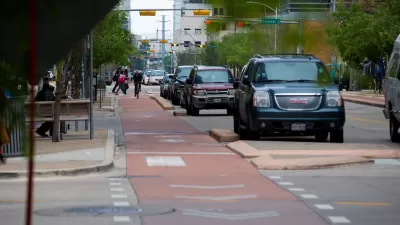
By analyzing the basic components of streets—like auto speed, traffic volume, and lane count—NACTO's formula can recommend a type of bike lane for a street with any combination of those factors. For example:
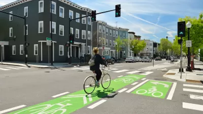
Got a two-lane, two-way 25 mph street that carries 4,000 autos per day? According to NACTO, a buffered bike lane will do. But if the traffic speed is 30 mph, it’s time to protect the bike lane with a curb, posts or planters.
In some cases, the guide also recommends changing the variables that make stricter precautions necessary in the first place—such as by slowing vehicular traffic to reduce the number and speed of cars passing by bike riders. Overall, the calculations are aimed at producing a "high-comfort" experience for riders "of all ages and abilities"—a higher standard than many existing local guides, Andersen points out.
FULL STORY: Which Bike Lanes Should Be Protected? New Guide Offers Specifics

Austin Outlaws Blocking Bike Lanes
Drivers who park in bike lanes will receive citations of up to $300.
NACTO Releases Updated Urban Bikeway Guide
The third edition of the nationally recognized road design guide includes detailed design advice for roads that prioritize safety and accessibility for all users.

Cleveland To Build First Protected Downtown Bike Lane
The city is taking steps to build out a more comprehensive bike lane network to connect downtown destinations.

Alabama: Trump Terminates Settlements for Black Communities Harmed By Raw Sewage
Trump deemed the landmark civil rights agreement “illegal DEI and environmental justice policy.”

Planetizen Federal Action Tracker
A weekly monitor of how Trump’s orders and actions are impacting planners and planning in America.

Why Should We Subsidize Public Transportation?
Many public transit agencies face financial stress due to rising costs, declining fare revenue, and declining subsidies. Transit advocates must provide a strong business case for increasing public transit funding.

Understanding Road Diets
An explainer from Momentum highlights the advantages of reducing vehicle lanes in favor of more bike, transit, and pedestrian infrastructure.

New California Law Regulates Warehouse Pollution
A new law tightens building and emissions regulations for large distribution warehouses to mitigate air pollution and traffic in surrounding communities.

Phoenix Announces Opening Date for Light Rail Extension
The South Central extension will connect South Phoenix to downtown and other major hubs starting on June 7.
Urban Design for Planners 1: Software Tools
This six-course series explores essential urban design concepts using open source software and equips planners with the tools they need to participate fully in the urban design process.
Planning for Universal Design
Learn the tools for implementing Universal Design in planning regulations.
Caltrans
Smith Gee Studio
Institute for Housing and Urban Development Studies (IHS)
City of Grandview
Harvard GSD Executive Education
Toledo-Lucas County Plan Commissions
Salt Lake City
NYU Wagner Graduate School of Public Service