


The NYC Transit Explorer from Sidewalk Labs shows how much transit service New Yorkers stand to lose when the L Train shuts down for 18 months.
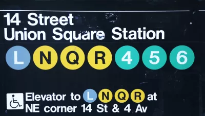
Dan Vanderkam writes a post to explain how Sidewalk Labs worked with the New York-based advocacy group Transportation Alternatives to create an interactive tool to illustrate how the looming shutdown of the L Train in New York will affect residents and commuters.
The tool is a map demo we’re calling the NYC Transit Explorer. It’s built on top of a transit router that uses the latest GTFS feeds for all MTA bus and subway lines, as well as the Staten Island ferry, to determine travel times and routes throughout the five boroughs. Traditional navigation routers direct people from Point A to Point B (call it one-to-one); our router adds the ability to show people how long it would take to get anywhere in the city via transit from a given origin (one-to-many).
After explaining the tool, Vanderkam then walks through step-by-step examples to show how the L Train closure will affect transit trips between Brooklyn and Manhattan—in terms of general accessibility and along specific routes. The post concludes with a call to action developers and civic hackers for help improving the tool.
FULL STORY: New map demo: How the L train shutdown will impact your commute

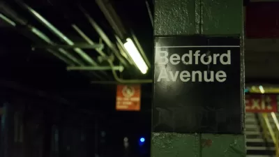
First Weekend of L Train Slowdown Could Have Been Worse
The long awaited repair work on the L Train between Brooklyn and Manhattan launched over the weekend.
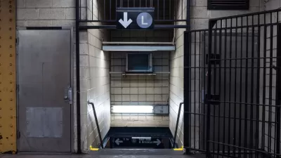
Breaking: Gov. Cuomo Cancels L Train Closure
Surprise, shocking news from New York City, as Governor Andrew Cuomo steps in at the 11th hour to change course on the highly anticipated (and dreaded) L Train closure scheduled to begin later this year.
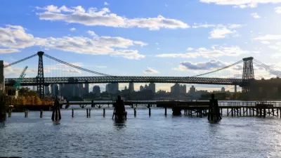
Single-Occupant Vehicles Banned on Williamsburg Bridge During L Train Closure
Solo commuters crossing from Brooklyn to Manhattan on the Williamsburg Bridge are in for a rude awakening on April 27 when the L Train closes. To accommodate more buses and bikes on the 115-year old bridge, cars will need at least 3 people.

Alabama: Trump Terminates Settlements for Black Communities Harmed By Raw Sewage
Trump deemed the landmark civil rights agreement “illegal DEI and environmental justice policy.”

Study: Maui’s Plan to Convert Vacation Rentals to Long-Term Housing Could Cause Nearly $1 Billion Economic Loss
The plan would reduce visitor accommodation by 25% resulting in 1,900 jobs lost.

Why Should We Subsidize Public Transportation?
Many public transit agencies face financial stress due to rising costs, declining fare revenue, and declining subsidies. Transit advocates must provide a strong business case for increasing public transit funding.

Wind Energy on the Rise Despite Federal Policy Reversal
The Trump administration is revoking federal support for renewable energy, but demand for new projects continues unabated.

Passengers Flock to Caltrain After Electrification
The new electric trains are running faster and more reliably, leading to strong ridership growth on the Bay Area rail system.

Texas Churches Rally Behind ‘Yes in God’s Back Yard’ Legislation
Religious leaders want the state to reduce zoning regulations to streamline leasing church-owned land to housing developers.
Urban Design for Planners 1: Software Tools
This six-course series explores essential urban design concepts using open source software and equips planners with the tools they need to participate fully in the urban design process.
Planning for Universal Design
Learn the tools for implementing Universal Design in planning regulations.
Caltrans
Smith Gee Studio
Institute for Housing and Urban Development Studies (IHS)
City of Grandview
Harvard GSD Executive Education
Toledo-Lucas County Plan Commissions
Salt Lake City
NYU Wagner Graduate School of Public Service