


City Profiles
Explore cities through an urban planning lens.
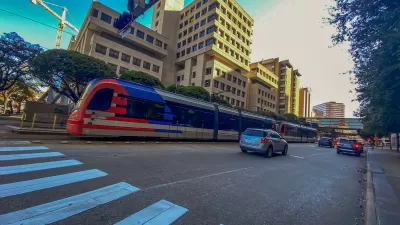
Houston: An Urban Planner's Guide to the City
Infamous for its lack of zoning codes, this east Texas port city grew thanks to the energy industry and an abundance of developable land.

Basics
- State: Texas
- Incorporation date: June 5, 1837
- Area: 671.67 sq mi
- Statehood: December 29, 1845
- Population*: 2,304,580
- Type of government: Strong mayor-council
- Planning department website: City of Houston Planning & Development Department
- Comprehensive plan: Plan Houston
*Current as of 2020 Census.
Houston's indigenous occupants
Prior to European colonization, the area now known as Houston was inhabited by the Karankawa and Akokisa people, who lived in settled villages and were documented by Álvar Núñez Cabeza de Vaca in 1528. Due to the brutal nature of colonization, little information about the native peoples of the area and their languages and cultures remains. Indigenous settlements were largely destroyed and displaced during the 1700s.
Colonization, the Texas Revolution, and the Buffalo Bayou
After Texas broke away from Mexico as an independent republic in the Texas Revolution, brothers John Kirby Allen and Augustus Chapman Allen bought 6,600 acres on the Buffalo Bayou in southern Texas, founding the city now known as Houston. The city served as capital of the Republic of Texas between 1837 and 1839. In 1845, Texas was admitted to the Union as a state. The city grew in importance thanks to its location on the bayou and the railroads that provided access to the area’s sugar plantations and the port of Galveston on the Gulf of Mexico.
20th century growth: Ports, rail, and oil
Long overshadowed by the larger port city of Galveston, Houston’s growth began in earnest after the hurricane of 1900 decimated Galveston and prompted the construction of the Houston Ship Channel, dedicated in 1914, and the Port of Houston farther inland. Discovery of oil at nearby Spindletop in 1901 and, later, oil refineries along the ship channel made Houston the center of a massive oil boom and energy industry that continues to provide a significant amount of jobs in the region. Houston became Texas’s most populous city by 1930. In the 1950s, the Houston Medical Center became operational, and NASA opened its Manned Spacecraft Center just southeast of Houston in 1962.
The Metropolitan Transit Authority of Harris County (METRO) is the local transit agency, operating buses, light rail, and paratransit services in the region. Though historically not known for widespread transit, Houston's network is expanding. The city is also developing a network of bike and pedestrian trails, particularly in the downtown area and along the Buffalo Bayou.
21st century concerns: Sprawl, hurricanes, and floodplain development
While the lack of restrictive zoning has historically kept Houston more affordable than many U.S. cities, the city has sprawled unsustainably, with single-family neighborhoods proliferating at a breakneck pace throughout the 1990s and early 2000s. More than three-quarters of the city’s commuters drove to work in 2016, and the city is known for its massive freeway interchanges, some of the largest in the country. With more residents wanting denser housing options near transit and amenities, development patterns are beginning to shift back toward the center of the city, creating more housing but also driving up housing costs in some previously depressed neighborhoods.
Unfettered development has also contributed to significant damage from flooding, hurricanes, and tropical storms including Hurricane Ike in 2008 and Hurricane Harvey in 2017. For decades, the city depended on its system of bayous and reservoirs to control flooding. Now, their capacity is increasingly inadequate in the face of modern storms. Increasingly long storm seasons and more powerful storms mean the city has to invest more resources in flood control and mitigation infrastructure, as well as relocation assistance for communities in low-lying areas. After 2017’s Hurricane Harvey, the city council passed new regulations requiring developers to elevate homes two feet above the 500-year floodplain, but state law still prohibits local jurisdictions from dictating exactly where developers can build.
Key planning milestones of Houston
- 1836: The first street plan for the city is created.
- 1929: The City Planning Commission recommends the first zoning ordinance, but the proposal gained little traction among local politicians. In fact, voters in the city have rejected proposed zoning ordinances three times: in 1948, 1962, and 1993. While Houston is famously known as the only major U.S. city without a zoning code, the city employs a combination of other planning and land use tools to regulate and guide development. Examples include historic districts, private deed covenants, lot size restrictions, and setbacks.
- 1942: An updated streets plan is released, emphasizing a radial road system branching out from downtown.
- 1983: The Harris County Toll Road Authority is created by voter approval to support a network of local toll roads aimed at reducing congestion.
- 1991: The City Council passes Houston’s first zoning regulations, which are reversed by voters in 1993.
- 2005: Over 100,000 evacuees from areas devastated by Hurricane Katrina relocate to Houston. Three years later, Hurricane Ike hits the Texas coast, causing $27 billion in property damage in Galveston and surrounding areas.


Houston Mayor Promises Dedicated Austin Street Bike Lane After Public Backlash
Although the one-way bike lane won’t be protected by physical barriers, the proposal is an improvement over the mayor’s initial plan to only include sharrows on the Austin Street project.

Preserving Houston’s ‘Naturally Occurring Affordable Housing’
Unsubsidized, low-cost rental housing is a significant source of affordable housing for Houston households, but the supply is declining as units fall into disrepair or are redeveloped into more expensive units.
Houston Metro Plan Centers Safety, Accessibility
A new plan from the city’s transit agency focuses on improving the rider experience and boosting safety, but remains uncommitted to previous plans to build new BRT lines.

Urban Design for Planners 1: Software Tools
This six-course series explores essential urban design concepts using open source software and equips planners with the tools they need to participate fully in the urban design process.
Planning for Universal Design
Learn the tools for implementing Universal Design in planning regulations.
Caltrans
Smith Gee Studio

Institute for Housing and Urban Development Studies (IHS)
City of Grandview
Harvard GSD Executive Education
Toledo-Lucas County Plan Commissions
Salt Lake City
NYU Wagner Graduate School of Public Service