


The Urban Nexus is an approach to sustainability that seeks to integrate sectors and silos int he design and development process.


Today's urban planners have a variety of resources at their disposal as they build and improve cities. Some of them depend on something called Urban Nexus science. It's a sustainable approach to creating integrated cities that focuses on promoting synergy between sectors and stakeholders.
The term Urban Nexus comes from the Urban NEXUS project 2013-2014. This project, which was funded by the German Development Cooperation, was established to study, identify, and document the "operationalization of the NEXUS approach in cities and metropolitan regions." The study used already established concepts such as integrated planning to find urban solutions to problems through uniting traditionally siloed services, jurisdictions, systems, etc. Many Urban Nexus approaches link numerous resources together, such as energy, food, and water.
Some scientists refer to this science as the energy-water-food nexus. They assert that city planning using this method involves those three components and that they are interdependent. Despite those realities, city planners and related professionals often view energy, food, and water as separate matters. Urban Nexus science aims to change that.
Some Urban Nexus science proposals look at other elements related to sustainability, like climate change and waste management. In any case, the goal is to understand how a city's systems link to each other and what must happen to help them promote sustainability for residents.
Here are some examples of how city planners have used this approach.
Motivating Positive Changes
Using Urban Nexus science can often encourage residents and other stakeholders to enact and maintain positive changes in their communities by looking at resources differently than they did before. In one case study in Nashik, India, the city planners dealt with multiple problems. Nashik is a major agricultural hub, but the techniques used for groundwater pumping were too energy-intensive. Moreover, much of the purchased land was used for residential purposes, but not for years after a sale.
As a result, there are large amounts of residentially zoned land that cut down the available property for agricultural use. Another problem is that the three areas focused on by this Urban Nexus approach—water, energy, and agriculture—were traditionally dealt with in separate departments.
Some components of Urban Nexus science for Nashik involved converting the un-utilized land into areas for agricultural or peri-agricultural use. Another task was to break down the organizational silos by creating a stakeholder group. Research also showed that the water pumps installed by farmers operated far below their peak efficiency. Then, farmers had to run them for extended periods and waste energy.
Besides saving energy with better water pumps, city planners in Nashik looked at key areas for mapping biogas potential and how those sections could increase energy independence. There was also another component of agricultural education in schools, including chances for children to visit an organic farm.
In Nashik, city planners tackled many needs at once. However, they hoped to urge city officials and residents to make positive changes that last. This Urban Nexus project caused them to conclude that interdepartmental planning is crucial for success, especially when getting the public involved.
Helping Infrastructure Match Growth Needs
A common problem urban planners experience is that existing infrastructure cannot tolerate urban growth. Stressed power and water systems can fail, adversely affecting the lives of residents. So, researchers proposed using the energy-water-food nexus to optimize water and energy investments with predictive models.
In their case study, the research team applied the models to Ghana. The choice of this case study could create a framework that simulated the effects of problems such as water scarcity and climate change. It depended on those models when making decisions about how and when to update the infrastructure. Although the researchers recognized their methods were not perfect, they saw the potential of using predictive techniques to see the effects of urban expansion.
Aiding Policymakers in Better Resource Management
Bringing the energy-water-food nexus into the equation has become so important that industries outside of city planning have increased involvement with the topic. In one instance, Dr. Richard Bonner, vice president of research and development at Advanced Cooling Technologies, was invited to testify in front of the House Science, Space and Technology Committee’s Energy subcommittee.
Like the city planners in Nashik realized in the example above, Bonner brought up the need for government, academia, and industry to cooperate for change. In some cases, people from various departments or separate organizations might share information to become more informed about the potential ramifications of the decisions they make.
A different analytics tool called the Extended Continental-scale Hydroeconomic Optimization (ECHO) model allows researchers to view water supplies across entire continents. Researchers can then see how water management ties into the energy and agricultural sectors. The team behind the project believes the ECHO model will help policymakers prevent water scarcity issues, as well as see how to optimize usage in places where water is not as readily available.
Looking at Transportation and Mobility Habits
City planners also have to become familiar with how people move around cities. Having that information allows them to build or improve transit routes, plus see where delays tend to happen and why. One group of researchers sought to apply Urban Nexus science to analyze people's movement based on information from sources like social media feeds.
They believed that by using this approach, smart cities become smarter by collecting data about how people live in those places. City planners can use the data to steer the choices they make regarding sustainable transport and mobility.
Statistics about transportation preferences show that in Phoenix and San Diego, 75% of people drive alone in their cars. In other cities, the percentage is even higher. Understanding how people get around won't be the sole thing that changes behaviors. However, once city planners get a handle on those statistics, they can assess opportunities to make transportation more sustainable.
Many Opportunities on the Horizon
The examples shown here emphasize how there is not a single way to apply Urban Nexus science to city planning. However, collaboration between parties is one of the essential components. As groups work together to tackle projects sustainably, they'll reveal thoughtful and relevant ways to use Urban Nexus science to achieve goals.

Planning Year in Review 2023: Zoning Reform, a Rail Revolution, and Climate Realities
Last year’s most talked-about planning issues and news.

Planetizen’s Top Posts of 2023
The most-read articles on Planetizen in 2023.

All We Want for the Holidays is…
Here are a dozen timely gift ideas for creating better communities.

Alabama: Trump Terminates Settlements for Black Communities Harmed By Raw Sewage
Trump deemed the landmark civil rights agreement “illegal DEI and environmental justice policy.”

Study: Maui’s Plan to Convert Vacation Rentals to Long-Term Housing Could Cause Nearly $1 Billion Economic Loss
The plan would reduce visitor accommodation by 25% resulting in 1,900 jobs lost.

Planetizen Federal Action Tracker
A weekly monitor of how Trump’s orders and actions are impacting planners and planning in America.

Wind Energy on the Rise Despite Federal Policy Reversal
The Trump administration is revoking federal support for renewable energy, but demand for new projects continues unabated.

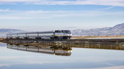
Passengers Flock to Caltrain After Electrification
The new electric trains are running faster and more reliably, leading to strong ridership growth on the Bay Area rail system.

Texas Churches Rally Behind ‘Yes in God’s Back Yard’ Legislation
Religious leaders want the state to reduce zoning regulations to streamline leasing church-owned land to housing developers.
Urban Design for Planners 1: Software Tools
This six-course series explores essential urban design concepts using open source software and equips planners with the tools they need to participate fully in the urban design process.
Planning for Universal Design
Learn the tools for implementing Universal Design in planning regulations.
Caltrans
Smith Gee Studio
Institute for Housing and Urban Development Studies (IHS)
City of Grandview
Harvard GSD Executive Education
Toledo-Lucas County Plan Commissions
Salt Lake City
NYU Wagner Graduate School of Public Service