


A new Google Maps redesign hopes to help make it easier to explore your surroundings. As with everything based on a mobile phone, the potential exists that it might also help ignore your surroundings.

According to a post on the official Google Maps blog, the popular mapping site made "a few visual changes and additions to Google Maps on desktop, Android and iOS to help you better explore the world around you."
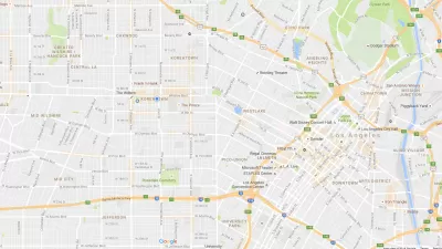
The changes are obvious, and won't have gone unnoticed to the well-trained eye of the Planetizen reader, but the post digs into the reasoning behind the changes. The post lists a "cleaner look" and a "more subtle and balanced color scheme" among the goals set for the redesign.
The most significant (and perhaps also the most debatable) feature of the redesign: the new information enabled by the cleaner look. Included now on Google Maps are "areas of interest," which Google determined "with an algorithmic process that allows us to highlight the areas with the highest concentration of restaurants, bars and shops." The areas of interest are shaded in orange, where users can "zoom in to see more details about each venue and tap one for more info." Watch the video below for an example of the new areas of interest function at work.
So, will areas deemed of interest by Google Maps benefit with more business and commercial activity, or suffer with additional congestion? And what about the areas deemed uninteresting, by default, for their lack of orange shading?
FULL STORY: Discover the action around you with the updated Google Maps


New Google Map Layer Shows COVID-19 Infection Rates
A new layer showing the seven-day average of confirmed COVID-19 cases started rolling out to Android and iPhones last week.
Google Maps Update Opens New Access to Mobility and Culture
Google Maps and other navigation and mapping apps have done a lot to inspire and educate people to make the most of their surroundings. New changes to the Google Maps app will add new functionality for those purposes.
Google Maps' 'Interesting' New Feature
Google's new maps redesign calls out areas of interest, but is "interesting" just a euphemism for rich?

Alabama: Trump Terminates Settlements for Black Communities Harmed By Raw Sewage
Trump deemed the landmark civil rights agreement “illegal DEI and environmental justice policy.”

Planetizen Federal Action Tracker
A weekly monitor of how Trump’s orders and actions are impacting planners and planning in America.

The 120 Year Old Tiny Home Villages That Sheltered San Francisco’s Earthquake Refugees
More than a century ago, San Francisco mobilized to house thousands of residents displaced by the 1906 earthquake. Could their strategy offer a model for the present?

Ken Jennings Launches Transit Web Series
The Jeopardy champ wants you to ride public transit.

BLM To Rescind Public Lands Rule
The change will downgrade conservation, once again putting federal land at risk for mining and other extractive uses.

Indy Neighborhood Group Builds Temporary Multi-Use Path
Community members, aided in part by funding from the city, repurposed a vehicle lane to create a protected bike and pedestrian path for the summer season.
Urban Design for Planners 1: Software Tools
This six-course series explores essential urban design concepts using open source software and equips planners with the tools they need to participate fully in the urban design process.
Planning for Universal Design
Learn the tools for implementing Universal Design in planning regulations.
Clanton & Associates, Inc.
Jessamine County Fiscal Court
Institute for Housing and Urban Development Studies (IHS)
City of Grandview
Harvard GSD Executive Education
Toledo-Lucas County Plan Commissions
Salt Lake City
NYU Wagner Graduate School of Public Service