


Not all streets are created equal: Some have sidewalks and some don't.

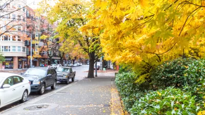
Stephen Fesler shares a map of Seattle streets that lack sidewalks—a hot button issue in Seattle where residents of some neighborhoods are "infuriated that they still don't have access to walking facilities in their neighborhoods."
The map reveals that streets north of 85th Street as well as streets in the Industrial District, West Seattle, and Southeast Seattle are lacking sidewalks.
"For a bit of perspective though, it's worth noting that Seattle has over 2,000 miles of sidewalks, which collectively cover 72% of city blocks. The City of Seattle estimates that replacement cost of this existing infrastructure is somewhere around $1.5 billion. But that still leaves some 900 miles (28% of city blocks) without any sidewalks; adding those to the pedestrian network would cost at least another $675 million."
The post goes on to explain how some of the neighborhoods without sidewalks got that way (hint: late incorporation) as well as how excuses and promises are sometimes what residents get instead of action regarding the state of pedestrian infrastructure in their neighborhoods.
FULL STORY: MAP OF THE WEEK: LACK OF SIDEWALKS IN SEATTLE

Proposal Could Mandate Sidewalks as Part of Seattle Complete Streets
Almost a third of the city’s neighborhood streets lack sidewalks.

Without Sidewalks, Making Seattle Streets More Pedestrian Friendly
Over a quarter of city blocks lack sidewalk infrastructure. An advocacy project to reduce traffic speeds and increase pedestrian safety on these streets has evolved into a city-funded program.

Seattle's New Updated Pedestrian Master Plan Includes $22 Million for Sidewalks
The promised update for the city of Seattle's Pedestrian Master Plan was released to the public last week.

Alabama: Trump Terminates Settlements for Black Communities Harmed By Raw Sewage
Trump deemed the landmark civil rights agreement “illegal DEI and environmental justice policy.”

Planetizen Federal Action Tracker
A weekly monitor of how Trump’s orders and actions are impacting planners and planning in America.

The 120 Year Old Tiny Home Villages That Sheltered San Francisco’s Earthquake Refugees
More than a century ago, San Francisco mobilized to house thousands of residents displaced by the 1906 earthquake. Could their strategy offer a model for the present?

In Both Crashes and Crime, Public Transportation is Far Safer than Driving
Contrary to popular assumptions, public transportation has far lower crash and crime rates than automobile travel. For safer communities, improve and encourage transit travel.

Report: Zoning Reforms Should Complement Nashville’s Ambitious Transit Plan
Without reform, restrictive zoning codes will limit the impact of the city’s planned transit expansion and could exclude some of the residents who depend on transit the most.

Judge Orders Release of Frozen IRA, IIJA Funding
The decision is a victory for environmental groups who charged that freezing funds for critical infrastructure and disaster response programs caused “real and irreparable harm” to communities.
Urban Design for Planners 1: Software Tools
This six-course series explores essential urban design concepts using open source software and equips planners with the tools they need to participate fully in the urban design process.
Planning for Universal Design
Learn the tools for implementing Universal Design in planning regulations.
Clanton & Associates, Inc.
Jessamine County Fiscal Court
Institute for Housing and Urban Development Studies (IHS)
City of Grandview
Harvard GSD Executive Education
Toledo-Lucas County Plan Commissions
Salt Lake City
NYU Wagner Graduate School of Public Service