


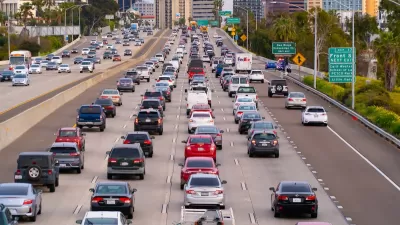
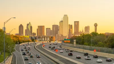
Analysis of the USDA’s 2010 National Resources Inventory, which tracks land use, shows the growth rate of suburban sprawl peaking in the mid-1990s, declining by two-thirds since then, even through the most recent housing boom. How did that happen?
Payton Chung provides new analysis of the USDA’s 2010 National Resources Inventory that shows sprawl beginning to slow in the mid-1990s and continuing to slow ever since. The findings don't indicate that sprawl is over, just that it's not expanding as quickly as it did in the past. The "inflection point," or the moment the rate of sprawl began to decrease, occurred perhaps earlier than many realized. As pointed out by Chung, peak sprawl also "predated 'peak car' by 10-15 years."
As for why peak sprawl occurred in the 1990s, Chung speculates: "the 1980s cessation of massive freeway construction may have pushed many metro areas into some version of Marchetti's Wall: the theory that people don't want to travel more than one hour a day, and thus that metropolitan growth has geometric limits tied to how far the predominant mode of travel goes."
Chung also notes that some of the consequences of sprawl, like Vehicle Miles Traveled, will be impacted by the slowing rate of outward growth. "A majority of the VMT benefits from more-central locations come from the fact that destinations are closer and car trips are shorter; only a minority of the benefits come from a switch to other modes. As growth recentralizes, perhaps VMT can be expected to decline further."
FULL STORY: As it turns out, suburban sprawl actually peaked 20 years ago

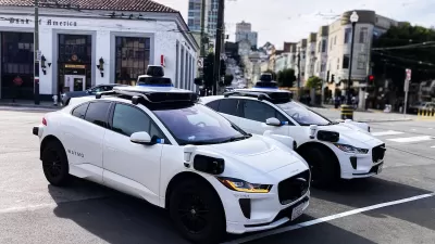
How Autonomous Cars Can Induce Sprawl and Sabotage Climate Goals
Robotaxis can lead to longer, more frequent trips and are projected to increase VMT by as much as 83 percent.
Opinion: Why Linking Driving to GDP Misses the Point
The argument that car-centric development is good because it boosts national GDP ignores the massive costs of driving to everyday Americans.
How to Reduce Excess Vehicle Travel
Some experts claim that remote work is the most effective way to reduce vehicle travel, but my research indicates that improving and encouraging walking, bicycling, and public transit can provide larger impacts and benefits.

What ‘The Brutalist’ Teaches Us About Modern Cities
How architecture and urban landscapes reflect the trauma and dysfunction of the post-war experience.

San Diego to Rescind Multi-Unit ADU Rule
The city wants to close a loophole that allowed developers to build apartment buildings on single-family lots as ADUs.

The VW Bus is Back — Now as an Electric Minivan
Volkswagen’s ID. Buzz reimagines its iconic Bus as a fully electric minivan, blending retro design with modern technology, a 231-mile range, and practical versatility to offer a stylish yet functional EV for the future.

Study: Walkability Can Help Reduce Dementia Risk
Walkable neighborhoods offer natural opportunities to stay active and engaged with friends and neighbors, increasing residents’ chances of remaining mentally and physically healthy longer.

Empower LA: The LA2050 Grants Challenge
The 2025 LA2050 Grants Challenge invites organizations to become outreach partners and help mobilize Angelenos to vote on how $1 million in grants will be allocated to address key local issues like homelessness, income inequality, and park access.

Take a Walk: Why Step Count Is the Most Valuable Fitness Metric
Step count remains the most valuable fitness metric for longevity and well-being, offering a simple yet powerful way to track daily movement, reduce health risks, and promote active lifestyles without reliance on complex data or technology.
Urban Design for Planners 1: Software Tools
This six-course series explores essential urban design concepts using open source software and equips planners with the tools they need to participate fully in the urban design process.
Planning for Universal Design
Learn the tools for implementing Universal Design in planning regulations.
City of Edmonds
City of Albany
Harvard GSD Executive Education
UCLA Lewis Center for Regional Policy Studies
Mpact (formerly Rail~Volution)
City of Piedmont, CA
Great Falls Development Authority, Inc.
HUDs Office of Policy Development and Research