


Many people believe that cities are dangerous due to exaggerated fears of urban crime. Cities are actually far safer and healthier than suburban and rural locations, and smart growth policies can further enhance their safety and health advantages.

Some risks are tangible – we can perceive them directly. For example, your heart rate probably increases when you stand near a high ledge or face an angry wild animal. A few years ago I took a fall while cycling around a tight corner and ended up with nasty road-rash; ever since I feel a healthy apprehension when approaching similar corners – my body remembers the pain – which has fortunately prevented subsequent falls. Such fear is rational and useful.
But many modern risks are intangible; they are measured statistically by experts and communicated through popular media. Not surprisingly, people often fear the wrong risks. This can have important implications for planning.
For example, a recent study, Safety in Numbers: Are Major Cities the Safest Places in the United States? compared injury death rates (the types of deaths that show up in emergency rooms, including motor vehicle crashes, homicides and suicides, poisoning, and other injury accidents) for U.S. counties rated on a ten-point urban-rural scale. After normalizing for demographic factors such as income, education and race it found that overall injury death risks are more than twice as high in the most rural counties than the most urban, primarily due to the approximately three times higher traffic accident fatality rates, as illustrated in the figure below.

Total injury deaths increase as counties become more rural, primarily due to the much higher traffic fatality rates, the largest cause of injury deaths. The most rural counties have approximately three times the traffic crash death rate as the most urban counties.
What I find surprising is that so many people consider these findings surprising. Many previous studies using various methodologies and data sets all indicate that more compact, multi-modal urban communities are safer than rural communities, and smart growth communities are safer than automobile-dependent communities. For example, William Lucy’s 2003 study, “Mortality Risk Associated With Leaving Home: Recognizing the Relevance of the Built Environment” showed that violent death rates (traffic fatality and homicide-by-stranger) are lower in cities than in exurban areas. Another 2003 study, titled Urban Sprawl As A Risk Factor In Motor Vehicle Occupant And Pedestrian Fatalities measured the traffic fatality rates of 280 U.S. counties rated according a sprawl index. The results indicate that the ten smartest growth counties have about a quarter of the average traffic fatality rate as the ten most sprawled counties as illustrated below.

The ten communities with the lowest sprawl rating have about a quarter of the per capita annual traffic fatality rates of the most sprawled communities.
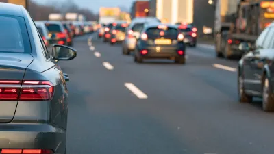
National-level analyses also show that among otherwise similar countries, traffic death rates increase with per capita vehicle travel, as illustrated below. Despite major investments in improved roads and vehicles, and numerous traffic safety programs, the U.S. has the highest per capita traffic fatality rate among peer countries, which can be explained by its high per capita vehicle mileage, as illustrated below.
Vehicle Mileage and Traffic Fatality Rates In OECD Countries (OECD Data)

Among economically developed countries there is a strong positive relationship between per capita vehicle travel and traffic deaths.
More fine-grained geographic analysis also indicates that compact urban neighborhoods are safer than lower-density, automobile-dependent neighborhoods. A 2009 study titled Safe Urban Form: Revisiting the Relationship Between Community Design and Traffic Safety, analyzed crash rates in San Antonio, Texas neighborhoods. Accounting for various demographic and geographic factors they found that increased vehicle travel tends to increase crash rates, with approximately 0.75% more crashes for every additional million miles of vehicle travel in a neighborhood; population density is significantly associated with fewer crashes with each additional person per net residential acre decreasing crash incidence 0.05%, and higher-speed roads also increase risk, with each additional mile of arterial roadway is associated with a 15% increase in total crashes. A 2008 study titled Network, Placemaking and Sustainability classified California cities by their per capita crash rates. It found that the safer cities had higher intersection densities and higher rates of walking, cycling and public transit travel.
Traffic deaths are so common they tend to receive little attention. In contrast, murders, particularly murders by strangers, receive dramatic media coverage. This distorts people’s understanding of risk. In fact, murder is a tiny risk to most people, those not involved in the drug trade or other high-conflict activities. While it is true that the neighborhoods with the highest murder rates tend to be in central cities, this reflects concentrated poverty. Most urban neighborhoods are no more dangerous than nearby suburban or rural areas.
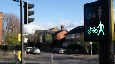
Smart growth helps achieve other public health objectives besides crash reductions: it also increases physical activity, reduces air pollution emissions and improves access to healthcare services. Overall, urban locations tend to be healthier than suburban locations, and can become even healthier with supportive policies such as safer walking and cycling conditions.
Key takeaways:
- Traffic accidents are the greatest risk to people between 5 and 50 years of age.
- Considering all risks, urban living is safer than suburban or rural living.
- Smart growth policies increase safety and public health.
- Most people and many experts fear the wrong risks.
For More Information
CDC (2010), CDC Transportation Recommendations, Center for Disease Control and Prevention.
Eric Dumbaugh and Robert Rae (2009), “Safe Urban Form: Revisiting the Relationship Between Community Design and Traffic Safety,”Journal of the American Planning Association, Vol. 75, No. 3, Summer 2009.
Reid Ewing, Richard Schieber and Charles V. Zegeer (2003), “Urban Sprawl As A Risk Factor In Motor Vehicle Occupant And Pedestrian Fatalities,” American Journal of Public Health, Vol. 93, No. 9, Sept., pp. 1541-1545.
Lawrence Frank, Andrew Devlin, Shana Johnstone and Josh van Loon (2010), Neighbourhood Design, Travel, and Health in Metro Vancouver: Using a Walkability Index, Active Transportation Collaboratory.
Norman W. Garrick and Wesley Marshall (2008), Network, Placemaking and Sustainability, Center for Transportation and Urban Planning, University of Connecticut.
Todd Litman (2013), “Transportation and Public Health,” Annual Review of Public Health, Vol. Vol. 34, pp. 217-233.
Todd Litman (2013), Safer Than You Think! Revising the Transit Safety Narrative, Transportation Research Board Annual Meeting paper 13-4357.
Todd Litman and Steven Fitzroy (2006), Safe Travels: Evaluating Mobility Management Traffic Safety Benefits, Victoria Transport Policy Institute.
Gord Lovegrove, Clark Lim and Tarek Sayed (2010), “Community-Based, Macrolevel Collision Prediction Model Use with a Regional Transportation Plan,” Journal Of Transportation Engineering, Vol. 136, No. 2, February 2010, pp. 120-128.
William H. Lucy (2003), “Mortality Risk Associated With Leaving Home: Recognizing the Relevance of the Built Environment,” American Journal of Public Health, Vol 93, No. 9, pp. 1564-1569.
Sage R. Myers, et al. (2013), “Safety in Numbers: Are Major Cities the Safest Places in the United States?” Annals of Emergency Medicine, American College of Emergency Physicians.
Vicky Feng Wei and Gord Lovegrove (2010), “Sustainable Road Safety: A New (?) Neighbourhood Road Pattern That Saves VRU (Vulnerable Road Users) Lives,” Accident Analysis & Prevention.

The Transportation Prescription
A new report identifies ways to incorporate health objectives into transportation and land use planning.

January Must-Reads: Top 10 Articles From Last Month
How a tidal wave of potential changes at the federal level could throw many programs planners depend on into chaos, a roundup of last year’s zoning stories, and the continuing ripple effects of a landmark Supreme Court case.
‘Safe Land Use:’ A Key to Road Safety
How approaching transportation planning through a public health lens can reduce traffic deaths.
Manufactured Crisis: Losing the Nation’s Largest Source of Unsubsidized Affordable Housing
Manufactured housing communities have long been an affordable housing option for millions of people living in the U.S., but that affordability is disappearing rapidly. How did we get here?

Americans May Be Stuck — But Why?
Americans are moving a lot less than they once did, and that is a problem. While Yoni Applebaum, in his highly-publicized article Stuck, gets the reasons badly wrong, it's still important to ask: why are we moving so much less than before?
Research Shows More Roads = More Driving
A national study shows, once again, that increasing road supply induces additional vehicle travel, particularly over the long run.

For Advice on Accessibility, Look to Iceland
Cities around the country installed over 1,700 wheelchair ramps in the last five years, thanks in part to one man’s initiative.

Toyota’s Hybrid Popularity Outpaces Production Worldwide
Soaring global demand for Toyota's hybrid vehicles is straining the automaker’s supply chain, leading to widespread delays as component shortages and limited production capacity challenge its ability to keep up.

Judge Halts Enforcement of Anti-Homeless Laws in Grants Pass
The Oregon city will be barred from enforcing two ordinances that prosecute unhoused residents until it increases capacity and accessibility at designated camping sites.
Urban Design for Planners 1: Software Tools
This six-course series explores essential urban design concepts using open source software and equips planners with the tools they need to participate fully in the urban design process.
Planning for Universal Design
Learn the tools for implementing Universal Design in planning regulations.
Heyer Gruel & Associates PA
City of Moreno Valley
Institute for Housing and Urban Development Studies (IHS)
City of Grandview
Harvard GSD Executive Education
NYU Wagner Graduate School of Public Service
City of Cambridge, Maryland
Newport County Development Council: Connect Greater Newport