


A new tool for assessing the quality of the park systems in America's cities was unveiled this week by The Trust for Public Land. Ryan Donahue delivers the rankings.
Calling it "the most comprehensive park rating system ever developed," The Trust for Public Land's ParkScore aims to "help city residents quantify their need for more and better parks, and
for city governments to craft effective and efficient plans to create
excellent park systems."
Developed using advanced GIS analysis and data collected by the Center for City Park Excellence, ParkScore assessed the park systems of the nation's forty biggest cities based on three primary factors: Acreage (median park size and percentage of city covered by parkland), Access (percentage of residents living within a half-mile walk of the nearest park), and Service & Investment (total spending per resident and playgrounds per 10,000 residents).
San Francisco came out on top in the inagural rankings, with Sacramento and New York filling out the top three. The lowest scoring cities are Fresno, Charlotte, and Louisville.
FULL STORY: What is Your City’s ParkScore?


2019 ParkScore Rankings Now Available
The trust for Public Land today announced the 2019 ParkScore rankings.
Which of America's Cities Has the Most Plentiful Parks?
Emily Badger looks at the latest "ParkScore" rankings released by the Trust for Public Land (TPL). Using advanced GIS, TPL ranks America's fifty largest cities by evaluating factors including park access, size, services and investment.
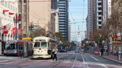
Waymo Gets Permission to Map SF’s Market Street
If allowed to operate on the traffic-restricted street, Waymo’s autonomous taxis would have a leg up over ride-hailing competitors — and counter the city’s efforts to grow bike and pedestrian on the thoroughfare.

Alabama: Trump Terminates Settlements for Black Communities Harmed By Raw Sewage
Trump deemed the landmark civil rights agreement “illegal DEI and environmental justice policy.”

Planetizen Federal Action Tracker
A weekly monitor of how Trump’s orders and actions are impacting planners and planning in America.

The 120 Year Old Tiny Home Villages That Sheltered San Francisco’s Earthquake Refugees
More than a century ago, San Francisco mobilized to house thousands of residents displaced by the 1906 earthquake. Could their strategy offer a model for the present?

Ken Jennings Launches Transit Web Series
The Jeopardy champ wants you to ride public transit.

BLM To Rescind Public Lands Rule
The change will downgrade conservation, once again putting federal land at risk for mining and other extractive uses.

Indy Neighborhood Group Builds Temporary Multi-Use Path
Community members, aided in part by funding from the city, repurposed a vehicle lane to create a protected bike and pedestrian path for the summer season.
Urban Design for Planners 1: Software Tools
This six-course series explores essential urban design concepts using open source software and equips planners with the tools they need to participate fully in the urban design process.
Planning for Universal Design
Learn the tools for implementing Universal Design in planning regulations.
Clanton & Associates, Inc.
Jessamine County Fiscal Court
Institute for Housing and Urban Development Studies (IHS)
City of Grandview
Harvard GSD Executive Education
Toledo-Lucas County Plan Commissions
Salt Lake City
NYU Wagner Graduate School of Public Service