


Real estate's favorite tool for gauging neighborhood walkability now has a companion for transit, Kaid Benfield reports.
As we mentioned earlier this month, the company Walk Score has made a name for itself by creating a system that anyone can use to determine how walkable a neighborhood is. Now, they're expanding that service to measure the usability of transit, too.
According to the index, the nation's top ten cities for transit are (in ascending order):
- Portland, OR (Transit Score: 50)
- Baltimore, MD (57)
- Miami, FL (57)
- Seattle, WA (59)
- Chicago, IL (65)
- Philadelphia, PA (68)
- Washington, D.C. (69)
- Boston, MA (74)
- San Francisco, CA (80)
- New York, NY (81)
Perhaps not surprisingly, the best eight cities for transit top Walk Score's walkability index, too (in a slightly different order).
Benfield explains how the numbers were crunched: "In calculating a Transit Score for a particular location, a 'usefulness' value is assigned to nearby transit routes based on frequency of service, type of route, and distance to the nearest stop on the route. City scores are then calculated by applying the Transit Score algorithm block-by-block throughout the city and weighting the scores by population density. Walk Score's web site contains a detailed description of the methodology used in the transit ratings."
FULL STORY: America's best cities for public transportation

The High-Tech Urban Experience, Now Standardized
The seven largest metros in the nation are teaming up to unify the technologies that are revolutionizing life in the city, Steve Towns reports.
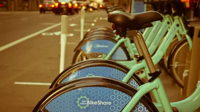
Bike Share Lessons From the Pandemic
Bike share data from six U.S. cities offer insight into how Americans have changed travel patterns during the pandemic.
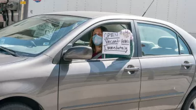
Hotels Could Play a Critical Role in Containing Coronavirus in Crowded Cities
Some cities are leasing entire hotels to provide rooms for people who have tested positive for COVID-19 or been exposed to infected people, to allow for safe and supportive isolation away from family or household members who risk being infected.

Alabama: Trump Terminates Settlements for Black Communities Harmed By Raw Sewage
Trump deemed the landmark civil rights agreement “illegal DEI and environmental justice policy.”

Planetizen Federal Action Tracker
A weekly monitor of how Trump’s orders and actions are impacting planners and planning in America.

The 120 Year Old Tiny Home Villages That Sheltered San Francisco’s Earthquake Refugees
More than a century ago, San Francisco mobilized to house thousands of residents displaced by the 1906 earthquake. Could their strategy offer a model for the present?

Ken Jennings Launches Transit Web Series
The Jeopardy champ wants you to ride public transit.

BLM To Rescind Public Lands Rule
The change will downgrade conservation, once again putting federal land at risk for mining and other extractive uses.

Indy Neighborhood Group Builds Temporary Multi-Use Path
Community members, aided in part by funding from the city, repurposed a vehicle lane to create a protected bike and pedestrian path for the summer season.
Urban Design for Planners 1: Software Tools
This six-course series explores essential urban design concepts using open source software and equips planners with the tools they need to participate fully in the urban design process.
Planning for Universal Design
Learn the tools for implementing Universal Design in planning regulations.
Clanton & Associates, Inc.
Jessamine County Fiscal Court
Institute for Housing and Urban Development Studies (IHS)
City of Grandview
Harvard GSD Executive Education
Toledo-Lucas County Plan Commissions
Salt Lake City
NYU Wagner Graduate School of Public Service