


A decade or so ago, after reading some of Jane Jacobs’ work, I became aware of the distinction between mixed-use and single-use neighborhoods. In those days, I imagined that in a well-functioning urban neighborhood, every non-polluting use would be mixed together, and the lion of housing would lay down with the lamb of commerce.

A decade or so ago, after reading some of Jane
Jacobs' work,
I became aware of the distinction between mixed-use and single-use
neighborhoods. In those days, I imagined
that in a well-functioning urban neighborhood, every non-polluting use
would be
mixed together, and the lion of housing would lay down with the lamb of
commerce.
But for the past few months, I have lived just
six blocks
from Jacobs' Toronto
house, in the Annex neighborhood. And in
the Annex, I have learned that the distinction between sprawl and
walkable
urbanism is a little more subtle than the bumper-sticker phrase
"mixed-use"
suggests.
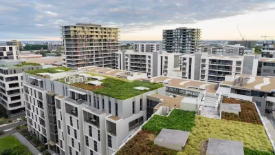
In the Annex, as in conventional sprawl
development (CSD),
most businesses are on a few major
streets, especially Bloor Street
West between Spadina and Bathurst.
Although Bloor has a few residences above shops, Bloor is
primarily a
commercial street.
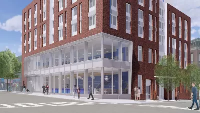
So how is Bloor different from San Jose
Boulevard (the sprawling
commercial street of my former neighborhood in Jacksonville)? Bloor's distinction rests less on diversity
of uses than on street design.
San Jose has a wide variety of commercial activities near some residential blocks, but is as wide as
eight lanes in some
spots- too wide to be comfortable for pedestrians. Bloor
is only four lanes wide, and is thus relatively
easy for pedestrians to cross. And on
Bloor, nearly every commercial building immediately adjoins the
sidewalk,
rather than being set back from the sidewalk by yards of parking.
As a result, pedestrians can easily access
shops, rather than dodging cars on the way to their destination. And because the nearby residential blocks
are part of a grid system, neighborhood residents don't have to hop from
cul-de-sac to cul-de-sac to reach Bloor's businesses. In
sum, Bloor is pedestrian-friendly less
because of mixed use than because of pedestrian-friendly street design
and
compact development.
The Annex's residential streets, like those in
my old neighborhood in Jacksonville, are at
least somewhat single-use: streets with large apartment complexes (St.
George
and Spadina near Bloor) have very few single-family structures, and
other
residential streets are dominated by houses and duplexes. So
in a sense, the Annex's streets are as
single-use as a typical suburban subdivision- both types of streets are
dominated
by one type of structure.
But there are two significant differences
between an Annex
street and a CSD street. First, some
of the Annex houses have been cut up into small apartments; thus, on an
Annex
street, single-family houses and duplexes often coexist with very small
apartment houses (though not with high-rises).
More importantly, the Annex's residential streets are more
compact than
their equivalents in sprawl subdivisions: houses are closer together,
and are
often duplexes. Thus, more people live
on an Annex street than live on a typical residential street in
Jacksonville, which means that the Annex has the density to support good public transit.
In sum, what makes the Annex walkable is not so much that every street mixes uses; rather, it is that the commercial streets are easily accessible from the residential ones, thus creating a mixed-use neighborhood.
NOTE: To see some examples of what I am talking about, go to Google Street View at maps.google.com. To see Bloor, go to anyplace between 350 and 600 Bloor Street West in Toronto. To see a typical residential street, go to Albany Avenue, just north of Bloor (Jane Jacobs lived on this stretch of Albany). To see an apartment-oriented street, go to St. George St. or Spadina Road just north of Bloor. To see my old sprawl street in Jacksonville, go to 10000 San Jose Boulevard in Jacksonville.

Where Urban Design Is Headed in 2024
A forecast of likely trends in urban design and architecture.

How Salt Lake City Maintained a Vibrant Downtown
Unlike other major cities, the Utah capital’s downtown has seen a steady stream of visitors even as demand for office space diminishes.
Brooklyn Library Comes With Affordable Housing
Combining affordable housing with a library reduced the cost of the project and gives residents access to essential resources.

Alabama: Trump Terminates Settlements for Black Communities Harmed By Raw Sewage
Trump deemed the landmark civil rights agreement “illegal DEI and environmental justice policy.”

Study: Maui’s Plan to Convert Vacation Rentals to Long-Term Housing Could Cause Nearly $1 Billion Economic Loss
The plan would reduce visitor accommodation by 25% resulting in 1,900 jobs lost.

Planetizen Federal Action Tracker
A weekly monitor of how Trump’s orders and actions are impacting planners and planning in America.

Wind Energy on the Rise Despite Federal Policy Reversal
The Trump administration is revoking federal support for renewable energy, but demand for new projects continues unabated.

Passengers Flock to Caltrain After Electrification
The new electric trains are running faster and more reliably, leading to strong ridership growth on the Bay Area rail system.

Texas Churches Rally Behind ‘Yes in God’s Back Yard’ Legislation
Religious leaders want the state to reduce zoning regulations to streamline leasing church-owned land to housing developers.
Urban Design for Planners 1: Software Tools
This six-course series explores essential urban design concepts using open source software and equips planners with the tools they need to participate fully in the urban design process.
Planning for Universal Design
Learn the tools for implementing Universal Design in planning regulations.
Caltrans
Smith Gee Studio
Institute for Housing and Urban Development Studies (IHS)
City of Grandview
Harvard GSD Executive Education
Toledo-Lucas County Plan Commissions
Salt Lake City
NYU Wagner Graduate School of Public Service