


I recently read Oscar Newman’s 1970s book on crime prevention, “Defensible Space.” In this book, Newman addressed the question of why some public housing projects are insanely dangerous, and others only moderately so. Although Newman’s analysis is mostly confined to low-income housing, commentators of all stripes have relied on his work: new urbanist commentator Laurence Aurbach asserts that Newman’s work supports new urbanists’ emphasis on heavily trafficked, walkable streets (1) while Randall O’Toole considers Newman to be a defender of single-use, cul-de-sac sprawl (2).

I recently read Oscar Newman's 1970s book on crime prevention, "Defensible Space." In this book, Newman addressed the question of why some public housing projects are insanely dangerous, and others only moderately so. Although Newman's analysis is mostly confined to low-income housing, commentators of all stripes have relied on his work: new urbanist commentator Laurence Aurbach asserts that Newman's work supports new urbanists' emphasis on heavily trafficked, walkable streets (1) while Randall O'Toole considers Newman to be a defender of single-use, cul-de-sac sprawl (2).
In Defensible Space, Newman seems to partially endorse the new urbanist theory that heavy pedestrian traffic creates "eyes on the street" and thus enhances security. He writes that housing project lobbies should should face public streets, because "streets provide security in the form of prominent paths for concentrated pedestrian and vehicular movements; windows and doorways, when facing streets, extend the zone of residents' territorial commitments and allow for the continual casual surveillance by police in passing cars." (3)
In particular, housing projects should be designed so that residents can see bordering streets from their windows; where housing projects look inward on themselves, "these bordering streets have been deprived of continual surveillance by residents and have proven unsafe to walk along". (4)
At a minimum, lobbies should be in a straight line from public streets because "Winding access paths provide many opportunities for muggers to conceal themselves while awaiting the arrival of a victim." (5).
By contrast, O'Toole asserts that Newman believed that mixed-use neighborhoods "suffered from higher crime than single-use neighborhoods."(6) Newman wrote that people generally feel safer on "heavily trafficked public streets and arteries combining both intense vehicular and pedestrian movement; commercial retailing areas during shopping hours; institutional areas; and government offices" (7) because "the presence of many people is seen as a possible force in deterring criminals." (8) Although Newman does not directly address mixed use in this part of his book, the notion that "heavily trafficked" streets are safer appears to be to support mixed use, because mixed use increases pedestrian traffic.
Newman goes on to write that even if a commercial street has a higher crime rate per resident, this may reflect the fact that "the number of pedestrians passing any point on the commercial street is over twenty times the average of surrounding streets and areas." (9) Thus, "the chance of occurrence per [street] user may be lower." (10) Moreover, the type of crime may differ in a more deserted, single-use area: while purse snatchings may occur on heavily trafficked streets, "aggravated assault would not be tolerated by witnesses (shopkeepers and other shoppers) on a well-trafficked commercial street" (11), while crime on deserted streets might be more likely to involve physical harm.
O'Toole cites page 112 of Defensible Space for the proposition that crime is higher in mixed-use areas.(12) On this page, Newman qualifies his prior assertion, stating:
two hamburger joints on the west side of the project, and the teenage play areas to the east, together generate high crime and vandalism rates in the immediately adjacent buildings. The New York City Housing Authority police has found that those of its projects located adjacent to commercial streets suffer proportionally higher crime rates ... The simple decision to locate commercial or institutional facilities within a project in order to increase activity and so provide the safety which comes with numbers must be critically evaluated in terms of the nature of the business, the intended users [and other factors]." (13)
English translation: commercial activities that attract teenagers might lead to higher crime rates than, say, a department store, because teenagers are more likely to commit crimes than middle-aged shoppers.(14)
Newman's position on density is less equivocal than his position on mixed use; he writes that "a correlation between density and crime rate for all New York City projects reveals that there is no evident pattern until one reaches a density of fifty units per acre"(15) - far more dense than most urban neighborhoods outside New York City, let alone suburbs (16). Thus, Newman appears to reject the notion that any increase in density automatically means more crime.
In sum, Newman's book hardly champions of low-density, single-use sprawl. In Defensible Space, he repeatedly emphasizes the importance of having common areas be visible to neighbors, he suggests that mixed use can at least sometimes (though not always) be good for neighborhood safety, and he does not believe density is harmful at the levels most common in even urban neighborhoods. But he is not a consistent an urbanist as Jane Jacobs; he views some uses as crimogenic, and does believe that density can be harmful in unusually high doses.
(1) See Laurence Aurbach, Connectivity Part 5, at http://pedshed.net/?p=72
(2) See Randall O'Toole, The Best Laid Plans 144-47 (2008).
(3) Oscar Newman, Defensible Space 25 (1972).
(4) Id. at 80.
(5) Id. at 82.
(6) O'Toole at 145.
(7) Newman at 109.
(8) Id.
(9) Id.
(10) Id.
(11) Id.
(12) O'Toole at 370.
(13) Newman at 112.
(14) Id. at 110-11 (discussing crime by teenagers, and suggesting that such crime more frequent in low-income housing projects where facilities catering to teenagers present).
(15) Id. at 195.
(16) Aurbach, The Density of Traditional Urbanism, at http://pedshed.net/?p=99 (Comparing density in numerous neighborhoods within Washington, DC metro area; even in walkable urban areas, density below 50 units per acre more often than not).


The Link Between Urban Design and Crime
A meta-study shows that public realm interventions can help reduce crime rates.
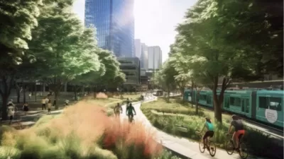
AI and Downtown Recovery: Missing the Mark in Seattle?
In his fourth GeekWire article on downtown recovery, Chuck Wolfe reviews the use of AI imagery in a section of the Seattle Downtown Activation Plan and suggests how it may have missed the mark.

Where Words Fail: Teach Architects and Urban Designers Like Violinists
Architects and urban designers justify or explain their work with words, and municipalities govern design with jargon-filled regulations. The outcome is often underwhelming.

Study: Maui’s Plan to Convert Vacation Rentals to Long-Term Housing Could Cause Nearly $1 Billion Economic Loss
The plan would reduce visitor accommodation by 25,% resulting in 1,900 jobs lost.

North Texas Transit Leaders Tout Benefits of TOD for Growing Region
At a summit focused on transit-oriented development, policymakers discussed how North Texas’ expanded light rail system can serve as a tool for economic growth.

Why Should We Subsidize Public Transportation?
Many public transit agencies face financial stress due to rising costs, declining fare revenue, and declining subsidies. Transit advocates must provide a strong business case for increasing public transit funding.

How Community Science Connects People, Parks, and Biodiversity
Community science engages people of all backgrounds in documenting local biodiversity, strengthening connections to nature, and contributing to global efforts like the City Nature Challenge to build a more inclusive and resilient future.

Alabama: Trump Terminates Settlements for Black Communities Harmed By Raw Sewage
Trump deemed the landmark civil rights agreement “illegal DEI and environmental justice policy.”

Dear Tesla Driver: “It’s not You, It’s Him.”
Amidst a booming bumper sticker industry, one writer offers solace to those asking, “Does this car make me look fascist?”
Urban Design for Planners 1: Software Tools
This six-course series explores essential urban design concepts using open source software and equips planners with the tools they need to participate fully in the urban design process.
Planning for Universal Design
Learn the tools for implementing Universal Design in planning regulations.
City of Santa Clarita
Ascent Environmental
Institute for Housing and Urban Development Studies (IHS)
City of Grandview
Harvard GSD Executive Education
Toledo-Lucas County Plan Commissions
Salt Lake City
NYU Wagner Graduate School of Public Service