


The San Francisco County Transportation Authority is working on two applications of congestion pricing for the city's downtown core and on a major road leading to the Golden Gate Bridge.
"Details of the congestion pricing initiatives under consideration in San Francisco have yet to be worked out.
But the goal is twofold: Reduce congestion by discouraging drivers from getting into their polluting cars and raise money for transit. City officials say Muni, for example, needs an extra $100 million a year to make significant service improvements. The money could also help promote biking and make streets safer for pedestrians."
"In addition to the grant for Doyle Drive, the federal government gave the city $1 million to study driving fees in San Francisco, particularly the downtown core and major arteries to and from the Bay Bridge."
"In San Francisco, the program could make use of the FasTrak electronic toll-collecting system," as opposed to utilizing the London technology, where "cameras snap photos of license plates, and drivers must pay the charge either before or on the day of travel. Such logistics have yet to be decided. The amount of the fee and how it would fluctuate according to the time or day and location also are unclear."
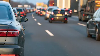
"On more than 60 percent of downtown streets, the average speed is less than 10 mph, according to local transportation planners, and the problem is expected to get worse with projected job growth and residential development over the next 25 years."
Both downtown cordon pricing and Doyle Drive projects need approval from city and state legislators.
"We think it's something that at least deserves consideration," said Tilly Chang, the San Francisco County Transportation Authority's deputy director for planning. "We wouldn't be looking at it if we didn't think it showed promise."
"The transportation authority's recommendations on fees are expected next summer."
"San Francisco Supervisor Jake McGoldrick, who chairs the San Francisco County Transportation Authority, said congestion pricing is a way to manage traffic and help fund transit. The idea fits well into San Francisco's "transit first" policy that tries to give high priority to the use of public transportation."
Thanks to Jennifer Alverson
FULL STORY: S.F. studying congestion pricing to ease traffic, promote transit

Manufactured Crisis: Losing the Nation’s Largest Source of Unsubsidized Affordable Housing
Manufactured housing communities have long been an affordable housing option for millions of people living in the U.S., but that affordability is disappearing rapidly. How did we get here?

Americans May Be Stuck — But Why?
Americans are moving a lot less than they once did, and that is a problem. While Yoni Applebaum, in his highly-publicized article Stuck, gets the reasons badly wrong, it's still important to ask: why are we moving so much less than before?
Research Shows More Roads = More Driving
A national study shows, once again, that increasing road supply induces additional vehicle travel, particularly over the long run.

Judge Halts Enforcement of Anti-Homeless Laws in Grants Pass
The Oregon city will be barred from enforcing two ordinances that prosecute unhoused residents until it increases capacity and accessibility at designated camping sites.

Advancing Sustainability in Los Angeles County Schools
The Los Angeles County Office of Education’s Green Schools Symposium brings together educators, students, and experts to advance sustainability in schools through innovative design, climate resilience strategies, and collaborative learning.

Using Old Oil and Gas Wells for Green Energy Storage
Penn State researchers have found that repurposing abandoned oil and gas wells for geothermal-assisted compressed-air energy storage can boost efficiency, reduce environmental risks, and support clean energy and job transitions.
Urban Design for Planners 1: Software Tools
This six-course series explores essential urban design concepts using open source software and equips planners with the tools they need to participate fully in the urban design process.
Planning for Universal Design
Learn the tools for implementing Universal Design in planning regulations.
City of Moreno Valley
Institute for Housing and Urban Development Studies (IHS)
City of Grandview
Harvard GSD Executive Education
NYU Wagner Graduate School of Public Service
City of Cambridge, Maryland
Newport County Development Council: Connect Greater Newport