


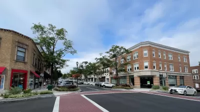
The public is providing feedback on the city of St. Paul's first-ever Pedestrian Plan.

"Despite slick and snowy conditions, a handful of residents showed up [earlier this month] for a public hearing to round out the public comment period on St. Paul’s first-ever Pedestrian Plan [pdf]," reports Cinnamon Janzer.
St Paul released the draft of the pedestrian plan in late 2018 as a potentially game-changing document for the future of walking in the city. Janzer provides context:
As the Monitor St. Paul reported, a majority of the city’s 1,080 miles of sidewalks are in poor condition because only six to eight miles are replaced each year. Additionally, the city has 330 miles of sidewalk gaps to contend with as well. Mayor Melvin Carter’s 2019 budget has almost doubled last year’s spending, earmarking $1 million for sidewalks.
According to Janzer, the plan is expected to appear before the City Council at a public hearing in March.

A New Pedestrian Plan for St. Paul
The city of St. Paul released a draft Pedestrian Plan in November, its first-ever addendum to the city's Comprehensive Plan to focus specifically on pedestrian safety.
Connecticut Launches Complete Streets Standards
The new policy calls for sidewalks, bike lanes, and crosswalks on state roads and state-funded road projects.

The Pandemic Has Not Been Kind to Pedestrian Skyways in the Twin Cities
Already a source of eternal controversy for their effects on street life and local business, pedestrian skyways have proven even more problematic during the pandemic.

Pennsylvania Mall Conversion Bill Passes House
If passed, the bill would promote the adaptive reuse of defunct commercial buildings.

Planning for Accessibility: Proximity is More Important than Mobility
Accessibility-based planning minimizes the distance that people must travel to reach desired services and activities. Measured this way, increased density can provide more total benefits than increased speeds.

World's Largest Wildlife Overpass In the Works in Los Angeles County
Caltrans will soon close half of the 101 Freeway in order to continue construction of the Wallis Annenberg Wildlife Crossing near Agoura Hills in Los Angeles County.

Eviction Looms for Low-Income Tenants as Rent Debt Rises
Nonprofit housing operators across the country face almost $10 billion in rent debt.

Brightline West Breaks Ground
The high-speed rail line will link Las Vegas and the Los Angeles area.

Colorado Bans No-Fault Evictions
In most cases, landlords must provide a just cause for evicting tenants.
City of Costa Mesa
Licking County
Barrett Planning Group LLC
HUD's Office of Policy Development and Research
Mpact Transit + Community
HUD's Office of Policy Development and Research
Tufts University, Department of Urban and Environmental Policy & Planning
City of Universal City TX
ULI Northwest Arkansas
Urban Design for Planners 1: Software Tools
This six-course series explores essential urban design concepts using open source software and equips planners with the tools they need to participate fully in the urban design process.
Planning for Universal Design
Learn the tools for implementing Universal Design in planning regulations.