


Planetizen needs your input in creating the definitive list of mobile apps for professional, student, academic, or citizen planners.

In keeping with tradition and the utility of the idea, Planetizen is updating its annual "Best Planning Apps" post. As in past years, the "Best Planning Apps" list depends on the input of Planetizen readers for insights into the use of apps and mobile phones in planning practices of all varieties—from the private sector to the public sector, academia, and advocacy groups.
To create a new, comprehensive Best Planning Apps lists for planners, and provide insights into trends in the future of app development for the planning profession, we are inviting you to take this survey. The survey will only take a couple minutes to complete. Please feel free to share the survey with colleagues as well.
Planetizen will use the data collected in this survey to produce a list of contemporary planning apps later this summer (but not too late). For an example of the kind of information we hope to generate, and then share, see Planetizen's Best Planning Apps post from 2018.
Take the Best Planning Apps survey for 2019.
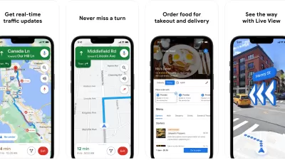
Recommended Mobile Apps for Urban Planning in 2023
Planetizen's annual list of top apps for planners is back, ten years after its first appearance on the site. Scores of apps have been recommended by planners as examples of planning in action, or tools for planning action.

Survey: Help Identify the Best Planning Apps of 2023
Planetizen needs your help updating the definitive list of mobile apps for professional, student, academic, or citizen planners.
Best Apps for Urban Planning in 2022
Mobile apps continue to redefine the practices of planning—urban planning, regional planning, transportation planning, community planning, and rural planning included.

Pennsylvania Mall Conversion Bill Passes House
If passed, the bill would promote the adaptive reuse of defunct commercial buildings.

Coming Soon to Ohio: The Largest Agrivoltaic Farm in the US
The ambitious 6,000-acre project will combine an 800-watt solar farm with crop and livestock production.

World's Largest Wildlife Overpass In the Works in Los Angeles County
Caltrans will soon close half of the 101 Freeway in order to continue construction of the Wallis Annenberg Wildlife Crossing near Agoura Hills in Los Angeles County.

California Grid Runs on 100% Renewable Energy for Over 9 Hours
The state’s energy grid was entirely powered by clean energy for some portion of the day on 37 out of the last 45 days.

New Forecasting Tool Aims to Reduce Heat-Related Deaths
Two federal agencies launched a new, easy-to-use, color-coded heat warning system that combines meteorological and medical risk factors.

AI Traffic Management Comes to Dallas-Fort Worth
Several Texas cities are using an AI-powered platform called NoTraffic to help manage traffic signals to increase safety and improve traffic flow.
City of Costa Mesa
Licking County
Barrett Planning Group LLC
HUD's Office of Policy Development and Research
Mpact Transit + Community
HUD's Office of Policy Development and Research
Tufts University, Department of Urban and Environmental Policy & Planning
City of Universal City TX
ULI Northwest Arkansas
Write for Planetizen
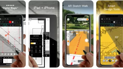
Urban Design for Planners 1: Software Tools
This six-course series explores essential urban design concepts using open source software and equips planners with the tools they need to participate fully in the urban design process.
Planning for Universal Design
Learn the tools for implementing Universal Design in planning regulations.